Central Slovakia · Industrial heritage and walking
Banská Štiavnica through its tajchy and mining galleries
A two-day escape to understand Banská Štiavnica through its steep historic centre, visitable mines and historic reservoirs that once powered its economy.
Conditions described in the guide: confirm current requirements and access with the official source before travelling.
Banská Štiavnica is best experienced as a system: a city of hills, shafts and public buildings that depends on a water landscape built for mining. The tajchy—artificial reservoirs connected by dams and channels—are not a recreational addition to the historic centre, but part of the same industrial landscape. Two days allow you to alternate between streets, museums and woodland without turning the visit into a race between monuments.
The right scale: a mining city, forest and water
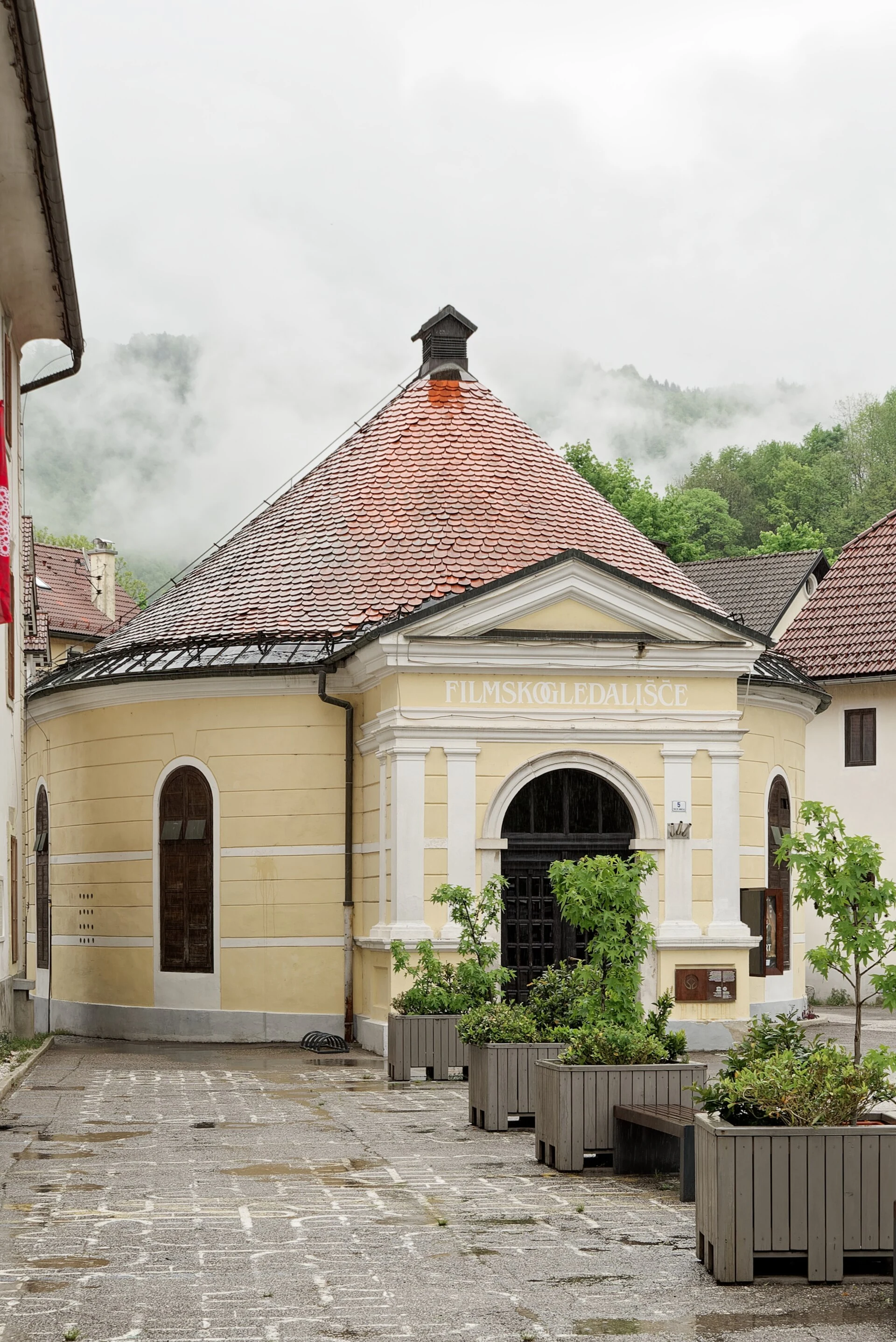
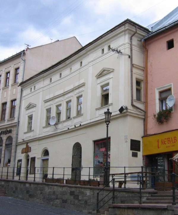
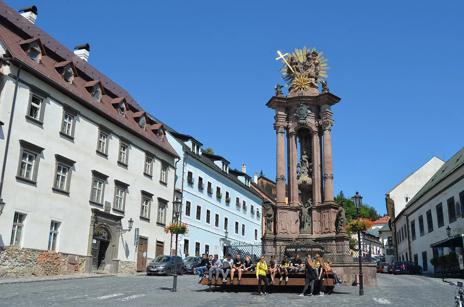
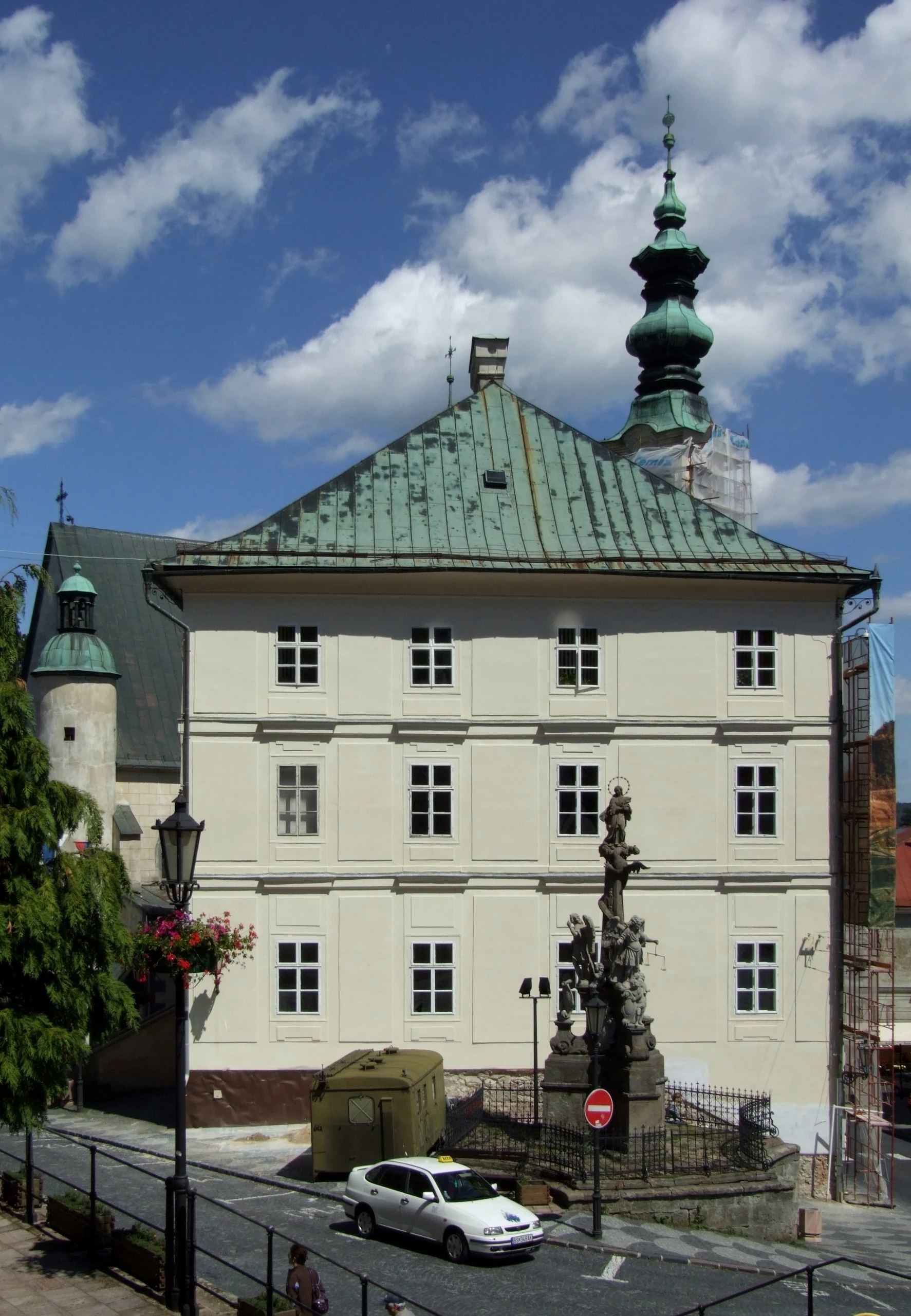
The historic centre occupies narrow hillsides, so short distances can involve continuous climbs. It is worth starting in the Holy Trinity Square and slowly following the streets linking St Catherine’s Church, the Old Castle and the former buildings of the Academy of Mining and Forestry. The most useful way to read the city is not to look for one isolated façade, but to observe how its urban architecture adapted to terrain that was organised for centuries around gold and silver extraction.
The heritage listing covers both the city and the technical monuments in its surroundings. That is why it is worth leaving room for a second day outside the centre: the reservoirs, channels and mining remains explain where the energy and water needed to pump and work the mines came from. Do not try to cover every tajch: choose one nearby for a short walk or a more distant one as the main excursion.
Day one: explore the city without separating beauty from work
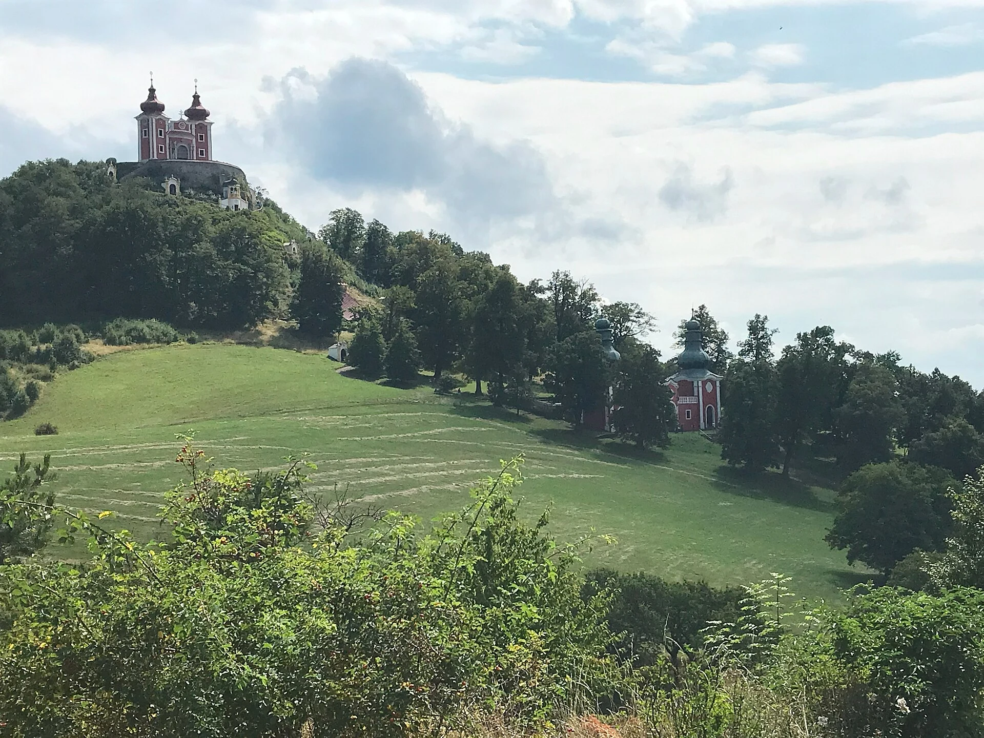
Spend the morning in the old town and accept that its cobbled, sloping stretches call for a slow pace. The Old Castle helps put the city’s defensive and religious development into perspective; the Calvary complex, visible from different points, reveals the relationship between the neighbourhoods and the hills. If your mobility is limited, organise the day by area rather than treating it as one continuous circuit: the slopes are a real condition of the visit, not a minor detail.
In the afternoon, allow time for the Slovak Mining Museum or a historical exhibition before heading underground. The city was a European centre for mining education, and its former academy is part of that history. This order—first the urban surface, then the objects and documents—provides context for a gallery visit: the mine stops being an isolated experience and becomes the infrastructure that sustained the city.
Day two: choose a tajch according to the effort you want
For a short outing with views, Ottergrund is an option focused on panoramas over the urban valley and the Calvary. It forms part of interpretive trails connected with the Terézia vein and makes it clear that the reservoirs were not natural lakes, but components of a hydraulic network. Wear shoes with good grip: even a brief walk may include uneven ground and elevation gain.
If you prefer a day of water and mountain scenery, Počúvadlo is the largest tajch in the area and lies at the foot of Sitno. From there, the climb to Sitno changes the character of the day: it is a mountain excursion, not an extended urban walk. Another option is the Sitno circuit, described as a roughly four-hour loop with mostly level terrain; even so, check the signage, ground conditions and state of the trail before setting out. In more strictly protected areas, stay on permitted routes and avoid leaving the paths.
Swimming, rentals, parking and local transport options are variable depending on the season. Check them with the regional tourist office before choosing a tajch as the day’s main destination.
The mine: a guided visit that requires planning ahead
The Slovak Mining Museum’s underground exhibitions are guided, operate during designated hours and require a valid ticket. The museum provides protective equipment for the tour, and its rules set specific conditions for minors and limits on group capacity. It is unwise to build a rigid itinerary around a particular gallery without confirming availability.
The practical decision is simple: choose the underground visit if you want to understand the material conditions of mining work and are comfortable with enclosed spaces, dampness and walking. If it does not suit you, the urban centre, the academy buildings and the tajchy system offer a complete reading of local history without entering a mine. Check opening hours, tour language, age requirements and reservations directly with the museum.
A responsible and workable visit
Banská Štiavnica rewards attention more than accumulation. Stay at least one night so you can divide your time between the city and the landscape, and avoid treating the tajchy solely as leisure spots: they are historic infrastructure and part of a protected forest environment. Bring water, an extra layer for changing weather and a downloaded map if you plan to walk beyond the centre; coverage and return options should not be taken for granted.
For a trip by car, the reservoirs greatly expand your options. Without a car, keep your plan focused on the centre and confirm local connections to your chosen tajch in advance. The trade-off is clear: more independence means more landscape, while a city-focused stay reduces logistics and lets you explore its industrial heritage in greater detail.
Sources to check before travelling
- UNESCO World Heritage Centre: the listing and documentation for the historic town of Banská Štiavnica and its technical monuments, including the tajchy hydraulic system.
- Slovak Mining Museum: current rules for underground exhibitions, guided access, equipment and visitor conditions.
- Banská Štiavnica Region: walking routes, Ottergrund, Sitno, Počúvadlo and seasonal information on services around the reservoirs.
- Slovakia’s national tourism organisation: historical context for the town, the tajchy and the protected landscape of the Štiavnické vrchy.
Consult these organisations before booking to confirm opening times, underground tours, trail conditions, local transport and seasonal services.
References consulted during editorial review. Times, requirements and advisories may change: always confirm with the official source.
- https://whc.unesco.org/en/list/618/maps/ whc.unesco.org
- https://whc.unesco.org/document/180594 whc.unesco.org
- https://slovakia.travel/en/banska-stiavnica slovakia.travel
- https://whc.unesco.org/document/153892 whc.unesco.org
- https://whc.unesco.org/document/181050 whc.unesco.org
- https://whc.unesco.org/archive/advisory_body_evaluation/618.pdf whc.unesco.org
- https://www.banskastiavnica.travel/attraction/vyhlad-z-najvyssie-polozeneho-tajchu/ www.banskastiavnica.travel
- https://slovakia.travel/en/stiavnicke-bane slovakia.travel
- Eslovaquia WikidataCC0 1.0 Wikidata · Q214
- Slovakia WikidataCC0 1.0 Wikidata · Q7541598
- Slovakia World Countries — mledozeODbL 1.0 World countries dataset by mledoze and contributors · ODbL 1.0
- Slovak Republic World Bank Open DataCC BY 4.0 World Bank
- Banská Štiavnica GeoNamesDatos geográficos bajo CC BY 4.0; requiere atribución a GeoNames. Fuente: GeoNames
- Banská Štiavnica GeoNamesDatos geográficos bajo CC BY 4.0; requiere atribución a GeoNames. Fuente: GeoNames
- Banská Štiavnica, District of Banská Štiavnica, Region of Banská Bystrica, 969 01, Slovakia OpenStreetMapODbL 1.0; atribución y obligación de compartir bases derivadas. Fuente: OpenStreetMap
- Počúvadlo GeoNamesDatos geográficos bajo CC BY 4.0; requiere atribución a GeoNames. Fuente: GeoNames
- Počúvadlo GeoNamesDatos geográficos bajo CC BY 4.0; requiere atribución a GeoNames. Fuente: GeoNames
- Počúvadlo, District of Banská Štiavnica, Region of Banská Bystrica, Slovakia OpenStreetMapODbL 1.0; atribución y obligación de compartir bases derivadas. Fuente: OpenStreetMap