Djibouti · Afar Depression
Lake Assal and Ghoubbet: a day of salt, lava and road
A trip from Djibouti City to Lake Assal and Ghoubbet calls for more road planning than mileage: water, communication and time to spare.
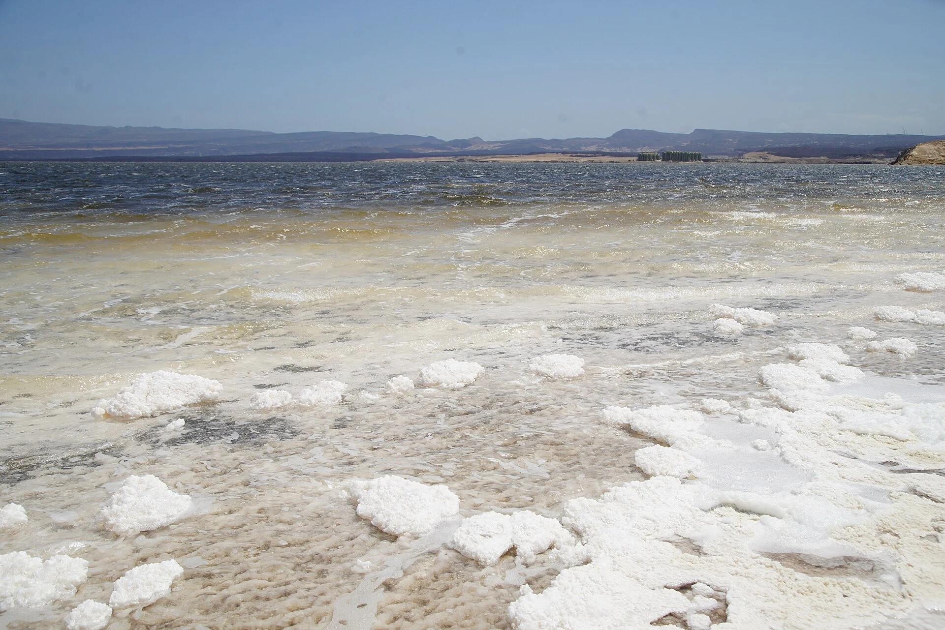
Lake Assal and the Ghoubbet inlet bring together two landscapes that explain Djibouti’s geology: a hypersaline depression below sea level and a volcanic coastline linked to the rift. The visual reward is considerable, but the key decision is logistical: plan a full-day excursion, arrange transport before leaving Djibouti City and do not rely on phone coverage. This is not an itinerary for improvising stops, water supplies or the return journey after dark.
It helps to think of the route as a sequence rather than two interchangeable viewpoints. Ghoubbet helps you read the relationship between sea, lava and faults; Lake Assal shifts the scale towards salt crusts, gypsum and a closed basin. Together, they deserve an attentive, low-impact visit—not a race to collect photographs.
A route for understanding the rift before reaching the salt
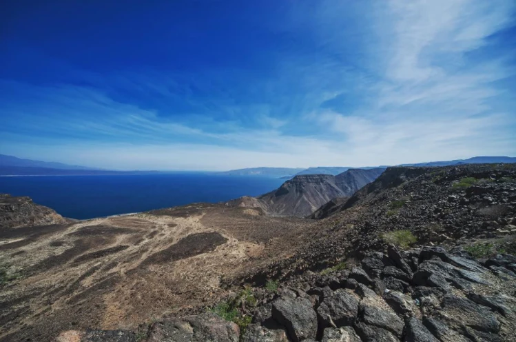
The national tourism agency places Lake Assal on the sightseeing route that also passes Ghoubbet Al-Kharab and the volcanic surroundings of Ardoukôba. Rather than saving the lake for the end as a mere photo stop, use Ghoubbet as your first reading of the landscape: the bay, Devil’s Island and the lava flows reveal a territory shaped by tectonic movements.
Lake Assal then provides the contrast: a salt basin far below sea level, surrounded by dark relief. Do not present it as a site isolated from the sea: its geological position and underground inflows help explain the concentration of salts. The difference between the two places is precisely what makes combining them in one day so worthwhile.
The published distance from Djibouti City to the Assal area is around one hundred kilometres, but do not turn that figure into a promise about journey time. Road conditions, stops and the heat determine the actual pace far more than the mileage.
Transport is the central decision
There is no reliable official guidance that allows this outing to be treated as a simple urban journey. Arrange a well-maintained vehicle with someone who knows the route, and agree in advance on the pickup point, the Ghoubbet–Assal sequence and a daytime return. If you travel independently, download maps and share your itinerary with your accommodation or a local contact.
The most practical consular advice for this area is clear: outside urban centres, the signal may be weak or nonexistent, especially on desert roads towards Lake Assal. Therefore, enough drinking water, fuel, a power bank and a first-aid kit are part of the plan, not optional extras. Avoid driving at night: limited lighting, poorly maintained vehicles, animals and obstacles on the road completely change the safety margin.
Do not assume that every stop will have shade, drinks for sale, toilets or roadside assistance. Take everything you brought back with you and reduce waste at the source; in an open mineral landscape, even a short visit leaves a trace.
What to do on the shores of Lake Assal
Take time to walk slowly through the authorised areas and observe how the shades change between salt, gypsum, water and volcanic rock. The best souvenir is reading the landscape, not collecting fragments: do not remove salt, minerals or other materials, and avoid climbing onto fragile surfaces or entering work areas.
The lake is part of a salt economy and a territory used by local communities. If you encounter extraction or transport activity, keep a practical distance, do not block the way and ask permission before photographing people. This simple guideline separates a respectful visit from an intrusion.
The national tourism office warns about the area’s hot springs. Do not mistake them for bathing areas or approach them without up-to-date local information. Ground and access conditions may change, so the person driving or accompanying the trip should confirm the most suitable drop-off point that same day.
Before booking, check three changing conditions
First, verify the entry channel applicable exclusively to your nationality through Djibouti’s official government e-visa portal or the relevant diplomatic mission. Requirements, accepted documents and processing times are liable to change; do not base an application on blogs, old screenshots or unofficial intermediaries.
Second, consult your country’s travel advisory just before setting out. As of September 2026, international consular advice calls for increased caution in Djibouti because of the risk of terrorism and advises against, or limits, proximity to the border with Eritrea. Lake Assal and Ghoubbet do not replace this general check: a nature itinerary is not outside the security context.
Third, confirm road conditions, departure time and the contingency plan in case of a breakdown or route change with the transport provider. If these three answers are unclear, postponing the excursion is a reasonable decision.
References to check before travelling
- Djibouti National Tourism Agency. Information sheets on Lake Assal, Ghoubbet Al-Kharab and national tourist sites; useful for locating the places and planning the route.
- Government eVisa portal of the Republic of Djibouti. The official channel for checking eligibility, documentation, procedure and e-visa validity.
- Consular authorities of the United States, Australia and Canada. Current advice on security, roads, communications and areas near the Eritrean border; review it on the day of departure.
- UNESCO and NASA. Context for distinguishing a tentative-list candidature from an inscribed designation and for checking Lake Assal’s topographic position.
References consulted during editorial review. Times, requirements and advisories may change: always confirm with the official source.
- https://travel.state.gov/en/international-travel/travel-advisories/djibouti.html travel.state.gov
- https://guide.visitdjibouti.dj/sites-touristiques/ guide.visitdjibouti.dj
- https://guide.visitdjibouti.dj/ guide.visitdjibouti.dj
- https://www.egouv.dj/sousmenu/sousmenu_selected_article/178/13 www.egouv.dj
- https://guide.visitdjibouti.dj/les-sites-cles-de-djibouti/ guide.visitdjibouti.dj
- https://primature.gouv.dj/reunion-de-suivi-des-projets-prioritaires-du-secteur-de-tourisme/ primature.gouv.dj
- https://diplomatie.gouv.dj/tourisme diplomatie.gouv.dj
- https://djibouti.embassy.qa/en/djibouti/tourism djibouti.embassy.qa
- Djibouti WikidataCC0 1.0 Wikidata · Q8273241
- Djibouti WikidataCC0 1.0 Wikidata · Q18206510
- Djibouti World Countries — mledozeODbL 1.0 World countries dataset by mledoze and contributors · ODbL 1.0
- Djibouti World Bank Open DataCC BY 4.0 World Bank
- Djibouti DBpediaCC BY-SA 3.0 DBpedia
- Lake Assal, Balho, Tadjourah, Djibouti OpenStreetMapODbL 1.0; atribución y obligación de compartir bases derivadas. Fuente: OpenStreetMap