Botswana · nature and planning
Makgadikgadi and Nxai Pan: Choosing Rain, Wildlife or the Scale of the Salt Flats
In the Makgadikgadi complex, the decisive choice is not accommodation but the state of the water. Nxai Pan, Nata and the Boteti plains follow different rhythms.
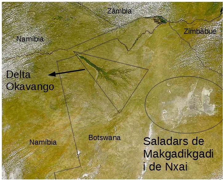
The Makgadikgadi complex is neither a single attraction nor a destination offering the same experience year-round. Its salt pans, grasslands, acacia islands and inhabited margins change with the rains; the trip should therefore be planned around whether you are seeking water-dependent wildlife, a dry and open landscape, or a closer look at the area’s human history. The key is to accept that climatic uncertainty is not a minor inconvenience here: it is part of the visit.
Three stops, three ways of seeing the salt pans
Nxai Pan National Park is the most direct choice for combining a large salt basin with a land-based safari. Its pans become covered in grass and smaller depressions hold water during the rainy season; the wildlife you see depends on this cycle and on migration. It is also the area whose approach is described as relatively accessible from the Nata–Maun road, although the final stretch and ground conditions should be checked before driving.
South of that road, Makgadikgadi Pans Game Reserve includes the western end of Ntwetwe Pan, grasslands and acacia groves. It may be the better fit if your main interest is watching herds of zebra and wildebeest move towards the Boteti region during the wet season, without turning a sighting into a promise: the rains determine where the wildlife will be.
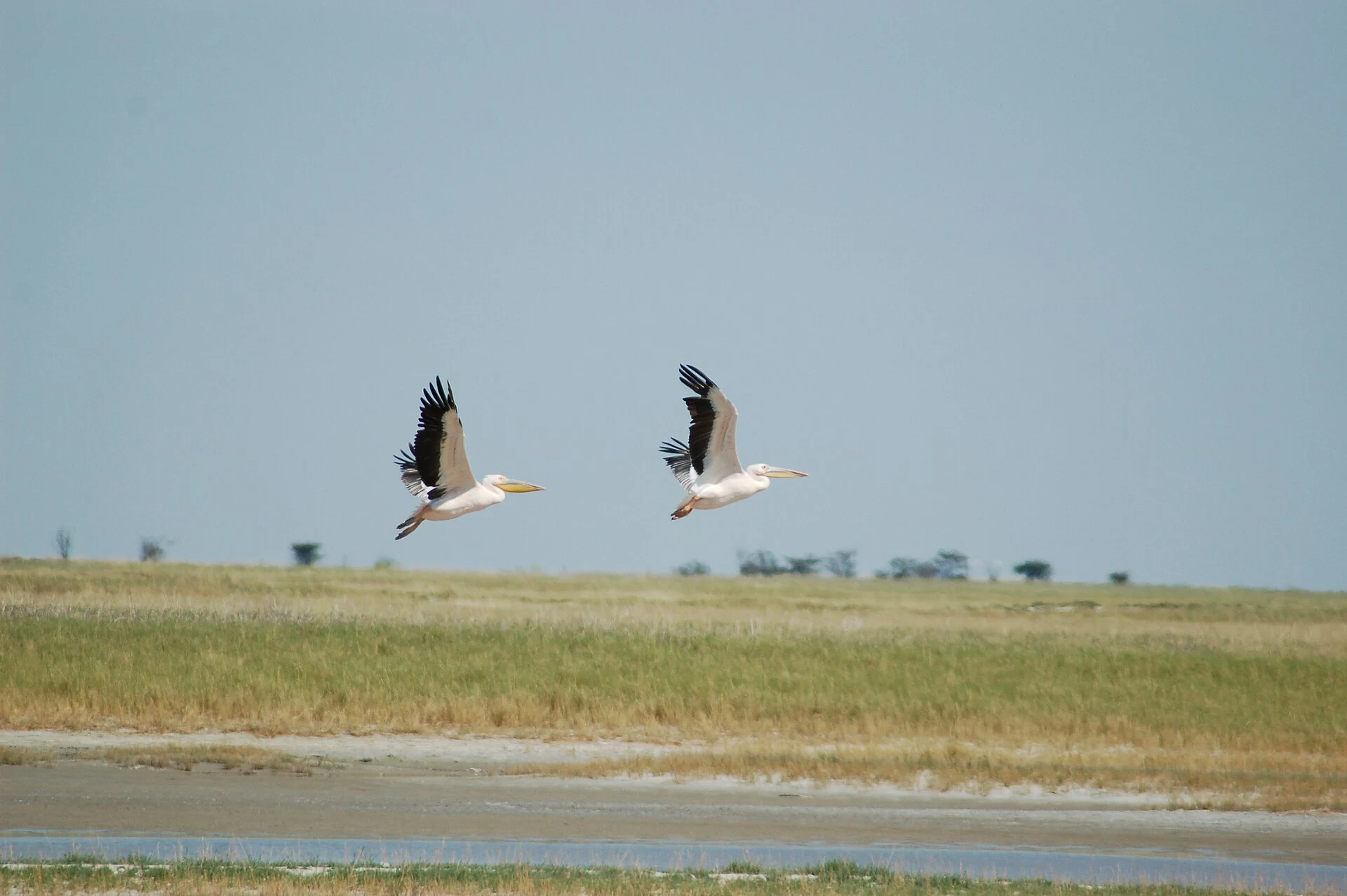
Nata Bird Sanctuary offers a third perspective. Located beside the eastern pans, it allows visitors to observe the relationship between temporary water and waterbirds from an elevated viewpoint when flooding occurs. It is also managed by residents of Nata, Maphosa, Sepako and Manxotae; choosing its services is a concrete way to link part of your spending to projects in these communities.
When to choose Nxai Pan and when to prioritise Nata
If you can travel between December and April, Nxai Pan deserves priority when the rains have been favourable: this is the period identified as particularly worthwhile for its wildlife potential, although results vary each year. It is a choice for accepting mud, changing routes and less predictable sightings in exchange for seeing the pans transformed into grasslands and pools.
For travellers visiting at another time or preferring a day focused on birds, Nata can be a reasonable alternative, but it should not be presented as a guarantee of flamingos. Its appeal depends on water being present in the pans. Before setting out, confirm the water level, access conditions and whether the viewpoint is operating with the sanctuary.
In the dry season, the appeal changes: the physical scale of the landscape takes centre stage, with white or dusty surfaces, long horizons and scattered vegetation. It is a good choice for travellers interested in geology, landscape photography and unhurried time; not for anyone expecting the concentration of animals associated with a favourable wet season.
Baines’ Baobabs: a brief stop that needs context
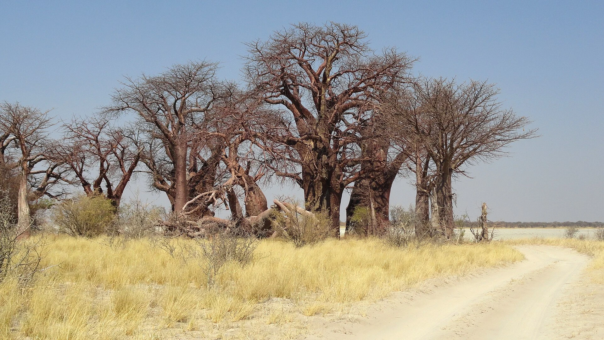
The seven baobabs of Baines’ Baobabs, near the Nxai Pan entrance, add a botanical and visual scale to an otherwise very horizontal landscape. The stop should not be reduced to repeating the gaze of the traveller and painter Thomas Baines, who depicted them in the nineteenth century. The group forms part of a landscape that also contains Stone Age sites, faunal remains, settlements associated with the Toutswe tradition and present-day communities around the edges of the pans.
This context matters because Makgadikgadi is not an empty space. Heritage records document human occupation and use from very early periods to the present, as well as archaeological sites and stone structures at different points in the system. Stay on authorised routes, do not collect materials and do not approach sensitive areas to obtain a photograph. The best souvenir here is usually leaving the place without adding a trace.
The logistics to settle before entering
Plan Makgadikgadi as a demanding self-drive destination or an organised excursion, not as an improvised extension of a road itinerary. The distance from the main road does not by itself explain the difficulty: rain, sand, mud and interior tracks can change the actual driving time. Carry enough water, fuel and food, and have an alternative plan; if you lack experience driving on sand or wet ground, consider an authorised operator.
For overnight stays in parks, reserves or public campsites, availability and booking procedures are sensitive to the time of travel. The Department of Wildlife and National Parks indicates an application and confirmation process for group stays, but requirements, spaces, fees and contacts must be checked directly before paying or departing.
Do not base your route on activities marketed as quad-bike rides or wildlife encounters. Ask who operates them, in which area, under what rules and how they avoid disturbing birds, animals and fragile surfaces. A responsible visit favours patient observation and authorised local businesses over recreational driving off track.
References to check before travelling
Consult these primary sources when finalising the itinerary: Botswana Tourism Organisation, the Nxai Pan National Park and Makgadikgadi Pans Game Reserve fact sheets; the Government of Botswana, Department of Wildlife and National Parks service for parks, reserves and campsites; and the UNESCO World Heritage Centre, the Makgadikgadi Pans Landscape tentative-list dossier.
Pay particular attention to track and access conditions, rain and flooding in the pans, the seasonal presence of wildlife and birds, bookings, fees, driving rules and available services. These details can change even within the same season.
References consulted during editorial review. Times, requirements and advisories may change: always confirm with the official source.
- https://whc.unesco.org/en/tentativelists/5559 whc.unesco.org
- https://whc.unesco.org/en/statesparties/bw whc.unesco.org
- https://whc.unesco.org/en/list/1545 whc.unesco.org
- https://whc.unesco.org/document/2629 whc.unesco.org
- https://whc.unesco.org/en/tentativelists/6095 whc.unesco.org
- https://gov.bw/tourism/group-tours-national-parks-game-reserves-or-campsites gov.bw
- https://whc.unesco.org/document/208817 whc.unesco.org
- https://gov.bw/taxonomy/term/108 gov.bw
- Botswana WikidataCC0 1.0 Wikidata · Q52345641
- Botswana World Countries — mledozeODbL 1.0 World countries dataset by mledoze and contributors · ODbL 1.0
- Botswana World Bank Open DataCC BY 4.0 World Bank
- Botswana DBpediaCC BY-SA 3.0 DBpedia
- Nxai Pan National Park GeoNamesDatos geográficos bajo CC BY 4.0; requiere atribución a GeoNames. Fuente: GeoNames
- Nxai Pan National Park, North-West District, Botswana OpenStreetMapODbL 1.0; atribución y obligación de compartir bases derivadas. Fuente: OpenStreetMap
- Ntwetwe Pan, Central District, Botswana OpenStreetMapODbL 1.0; atribución y obligación de compartir bases derivadas. Fuente: OpenStreetMap
- Nata Bird Sanctuary, Central District, Botswana OpenStreetMapODbL 1.0; atribución y obligación de compartir bases derivadas. Fuente: OpenStreetMap