Santander · Heritage walking route
Barichara and Guane on foot along the Camino Real
A downhill walk from Barichara to Guane to understand what the Camino Real protects, how much effort it requires and how to plan the day without turning it into a race.
Conditions described in the guide: confirm current requirements and access with the official source before travelling.
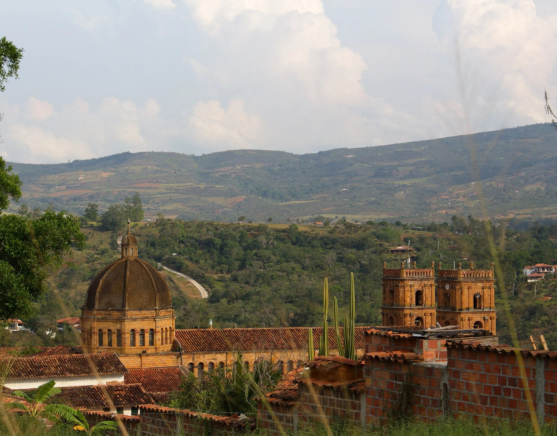
Barichara is best experienced as a place to walk slowly, but the plan that gives the trip its structure lies beyond its streets: the descent to Guane along the Camino Real. This is not a scenic shortcut or a filler excursion, but a protected route where the stone, dry-stone walls and slope tell a story of Indigenous, colonial and republican connections. The practical key is to treat it as a walk over uneven terrain, with your return arrangements settled before setting out.
If you can, spend a night in Barichara. You will then have time to explore the historic centre without rushing and choose a cool morning for the trail. Guane should not be merely a photographic destination; it is where the route’s scale is completed by its square, church and small archaeological and palaeontological museum.
A protected route, not one long cobbled street
The route between Barichara and Guane is recognised as a national cultural heritage asset. The protection covers more than the paving: it includes the relationship between the stone route, dry-stone walls, waterways and the dry-forest landscape accompanying the descent.
The historical interpretation requires nuance. The current path was built over a route used by the Guane people, incorporated colonial-era circulation networks and was altered in the nineteenth century. It is therefore best not to present it as an unchanged scene from the past: it is infrastructure with different layers, maintained and used in an inhabited territory.
Start in Barichara with enough time to locate the access point and descend at your own pace. Heritage regulations establish its exclusively pedestrian character: do not expect a route suitable for motor vehicles, and do not base your logistics on a car being able to follow you along the trail.
The descent to Guane: pace, stone and simple decisions
The resolution protecting the route describes a seven-kilometre trail beginning with a zigzag descent from the town centre. Other tourism materials give slightly different measurements depending on the starting and finishing points; treat the distance as guidance, not as a promise of an exact duration. The usual estimate of two hours applies to walking without letting stops, heat or photographs create a scheduling problem.
The effort lies in the sustained slope and uneven paving, not in the altitude. Wear shoes with firm soles, bring water and sun protection, and carry a light rain layer; shade is not guaranteed throughout the route. Anyone with balance difficulties, knee pain or reduced mobility should consider reaching Guane by road rather than walking downhill.
Take the route one way, from Barichara to Guane, to make the most of the descent. Before leaving, confirm locally how you will return to Barichara or whether you prefer to continue to another point in the region. That check matters more than trying to fit the day into a published duration.
Guane as an arrival, not a rushed stop
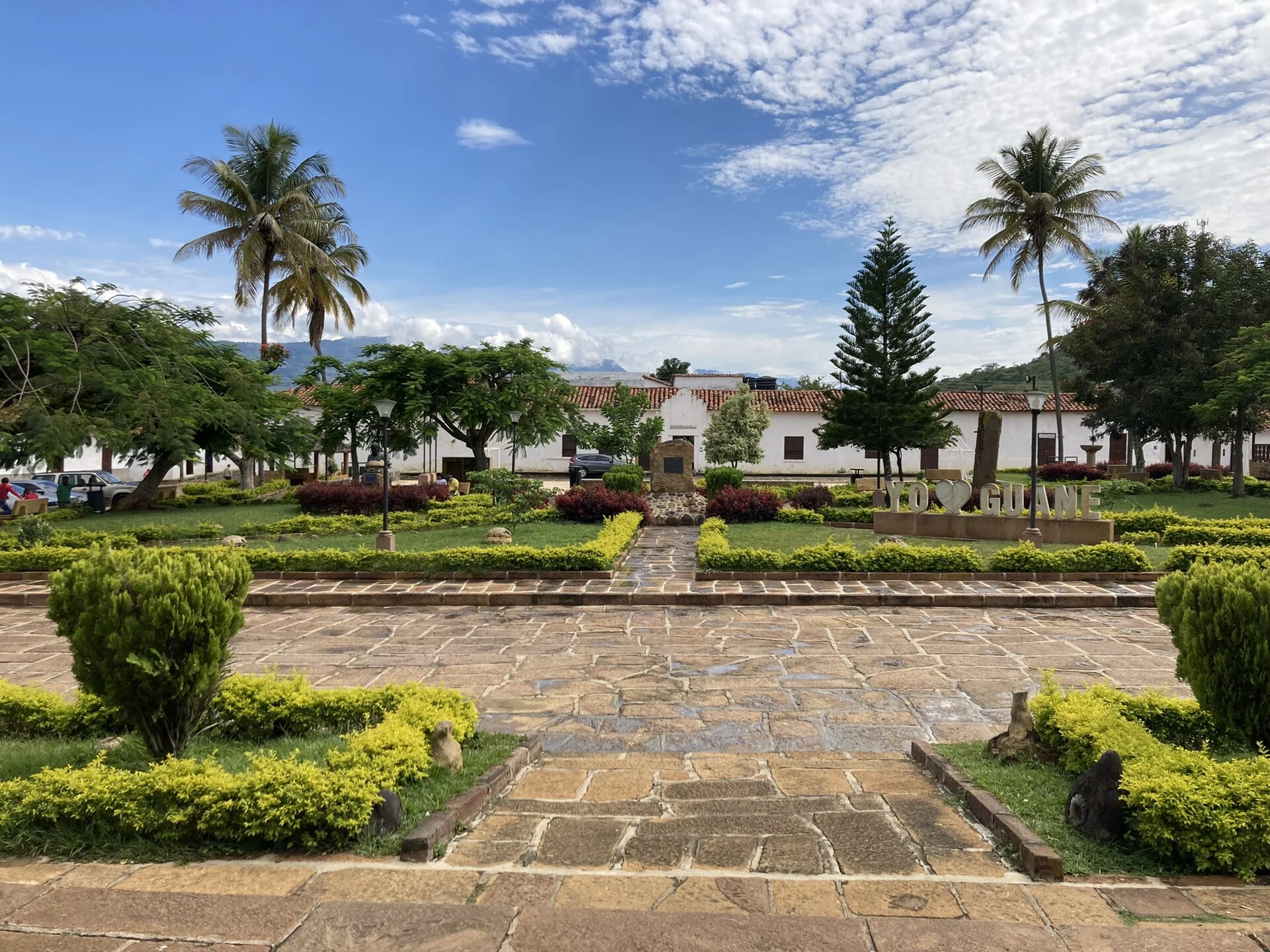
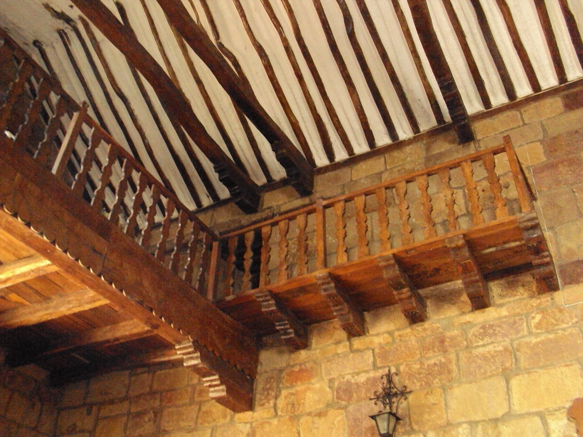
When you arrive, set aside time to walk around the square and take in the village’s intimate scale before entering the Archaeological and Palaeontological Museum. Its collection brings together fossils and objects associated with Guane culture; it helps distinguish between the landscape you have just crossed and the material evidence that helps interpret it.
Do not turn the museum into a source of archaeological souvenirs: do not collect or buy artefacts whose provenance is not clearly documented. In a place where heritage is linked as much to the subsoil as to the architecture and the route, responsible purchasing matters as much as behaviour on the trail.
Museum opening hours, the route’s current condition, return transport and any operational restrictions may change. Check them with official sources or directly in Barichara before committing to the walk, especially if you need to coordinate connections or mobility assistance.
References to check before setting out
- Colombia’s Ministry of Cultures, Arts and Knowledge, Resolution 790 of 1998: heritage designation and description of the Camino Real between Barichara and Guane.
- Colombia’s Ministry of Cultures, Arts and Knowledge, Resolution 688 of 2015: management and protection plan, associated landscape and the route’s pedestrian character.
- Colombia Travel, listing for Guane’s Archaeological and Palaeontological Museum: guidance on arriving in Guane on foot and on the museum’s contents.
- National Tourism Fund, Heritage Towns guide: context on the Guane Trail and the area around Barichara.
- Cotrasangil, destinations listing: check there before travelling to confirm the current operation of ground routes to Barichara.
Key points for deciding
- The Camino Real makes Barichara a worthwhile choice if you are looking for a walkable heritage route, not just a stroll through the historic centre.
- Walk downhill from Barichara to Guane and decide how you will return before starting: the route is pedestrian-only and the logistics should not be improvised.
- Expect uneven stone, a descent and exposure to the sun; this route is not suitable for every level of mobility.
- Stay in Guane long enough to visit its square and museum, and confirm opening hours and transport on the same day or before setting out.
References consulted during editorial review. Times, requirements and advisories may change: always confirm with the official source.
- https://colombia.travel/es/barichara/visita-el-museo-arqueologico-y-paleontologico-de-guane colombia.travel
- https://normograma.mincultura.gov.co/compilacion/docs/resolucion_mincultura_0790_1998.htm normograma.mincultura.gov.co
- https://colombia.travel/es/macondo-colombia/tierra-colombiana/destinos-del-pais-belleza-con-esencia-macondo-colombia colombia.travel
- https://colombia.travel/es/blog/cuatro-pueblos-patrimonio-de-colombia colombia.travel
- https://colombia.travel/es/blog/barichara-colombia-un-destino-de-aventura-e-historia colombia.travel
- https://normograma.mincultura.gov.co/compilacion/docs/resolucion_mincultura_4261_2018.htm normograma.mincultura.gov.co
- https://colombia.travel/en/macondo-colombia/colombian-destinations/destinations-with-the-essence-of-macondo-colombia colombia.travel
- https://colombia.travel/es/bogota/descubre-el-turismo-ecuestre-en-colombia colombia.travel
- Colombia WikidataCC0 1.0 Wikidata · Q739
- Colombia WikidataCC0 1.0 Wikidata · Q2462831
- Colombia WikidataCC0 1.0 Wikidata · Q678284
- Colômbia WikidataCC0 1.0 Wikidata · Q1760531
- Colombia WikidataCC0 1.0 Wikidata · Q1576192
- Colombia World Countries — mledozeODbL 1.0 World countries dataset by mledoze and contributors · ODbL 1.0
- Colombia World Bank Open DataCC BY 4.0 World Bank
- Colombia DBpediaCC BY-SA 3.0 DBpedia
- Colombia en posconflicto: ¿turismo para la paz o paz para el turismo? OpenAlexCC0 1.0 OpenAlex
- Impactos del turismo sobre el crecimiento económico y el desarrollo. El caso de los principales destinos turísticos de Colombia OpenAlexCC0 1.0 OpenAlex
- Diagnóstico de competitividad del turismo en Boyacá (Colombia) OpenAlexCC0 1.0 OpenAlex
- Inspección de accesibilidad mínima sobre el portal de turismo del Instituto de Cultura y Turismo de Bolívar-Colombia CrossrefMetadatos públicos; derechos específicos por campo cuando correspondan Crossref
- APORTES PARA ENTENDER LA SOSTENIBILIDAD DEL TURISMO DE NATURALEZA. CrossrefMetadatos públicos; derechos específicos por campo cuando correspondan Crossref
- La sostenibilidad en las playas turísticas de Colombia CrossrefMetadatos públicos; derechos específicos por campo cuando correspondan Crossref
- Barichara GeoNamesDatos geográficos bajo CC BY 4.0; requiere atribución a GeoNames. Fuente: GeoNames
- Barichara GeoNamesDatos geográficos bajo CC BY 4.0; requiere atribución a GeoNames. Fuente: GeoNames
- Barichara, Guanentá, Santander, RAP Gran Santander, 684041, Colombia OpenStreetMapODbL 1.0; atribución y obligación de compartir bases derivadas. Fuente: OpenStreetMap
- Barichara, Guanentá, Santander, RAP Gran Santander, 684041, Colombia OpenStreetMapODbL 1.0; atribución y obligación de compartir bases derivadas. Fuente: OpenStreetMap