Basque Coast, Gipuzkoa
Exploring Zumaia’s Flysch Coast from Viewpoints and Trails
In Zumaia, the best plan is not to make your way down to the rocks at all costs. It is to choose between trails, viewpoints and the sea according to the time available and the state of the tide.
Conditions described in the guide: confirm current requirements and access with the official source before travelling.
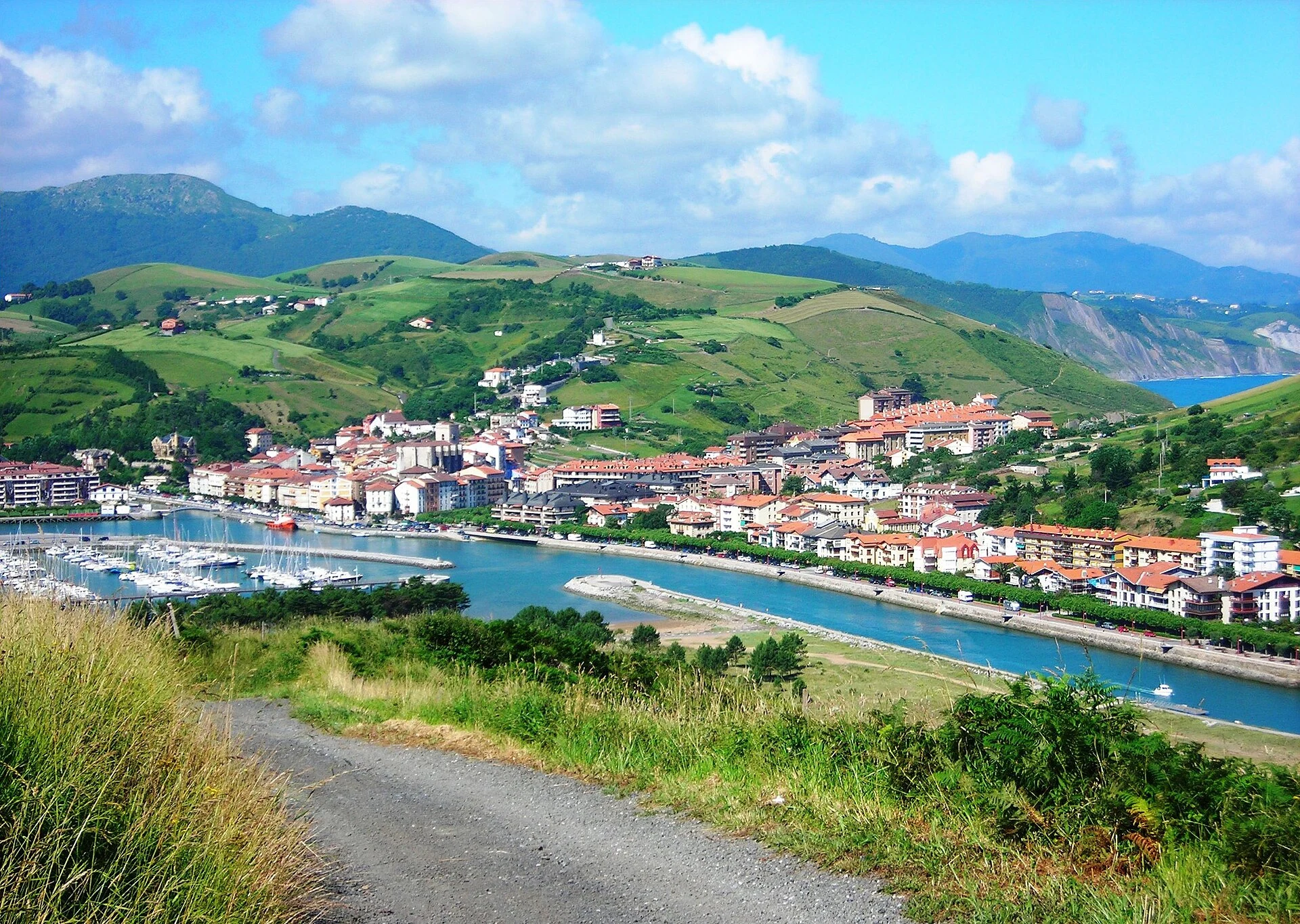
Zumaia is a coastline best understood slowly: the inclined strata of the flysch form a geological archive visible from land, while the intertidal platform changes dramatically with the sea. The useful decision is not to seek the closest photo of the rocks, but to choose an experience compatible with the tide, the terrain and the way you like to walk.
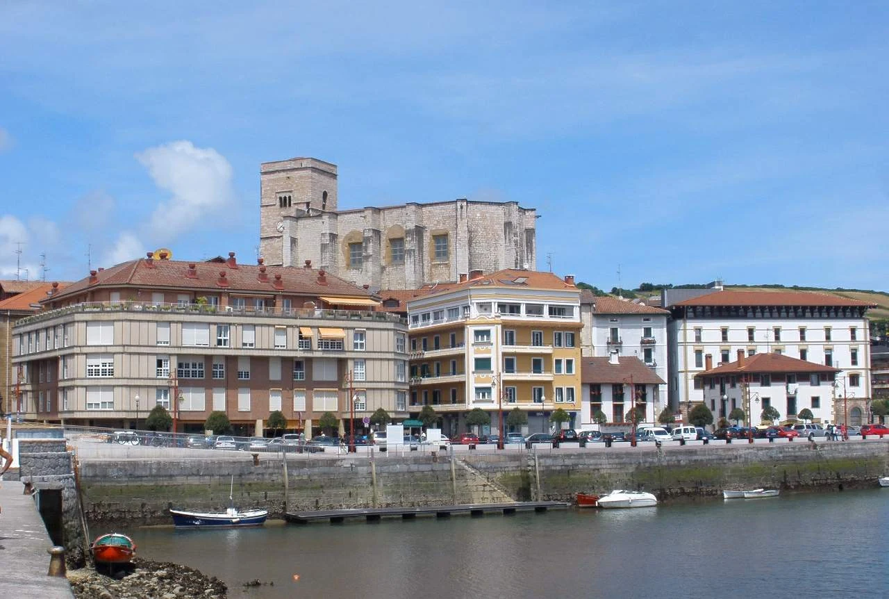
The town works well as a car-free base for a day of short hikes and observation. Anyone wishing to cover longer stretches of coast or sail alongside the cliffs will need to adjust the logistics to train timetables, available departures and the day’s maritime conditions.
Choose the scale of your visit before setting out
The flysch is not a single photographic spot. It is a succession of folded sedimentary layers exposed along the coast between Deba and Zumaia; around Itzurun and Algorri, it allows visitors to read tens of millions of years of Earth’s history. Looking from above already offers a complete experience and avoids turning the rocky platform into an improvised route.
For a first visit, the Algorri trail, which starts at the chapel of San Telmo, concentrates the Palaeocene section and its key geological features. It is a suitable option if you are looking for a short approach from the town. If you prefer broader landscapes, the Elorriaga viewpoint and circuit offer a 2-kilometre circular walk, estimated at around 45 minutes, through countryside and along the cliff edge. They are not equivalent alternatives: Algorri brings you closer to the detail of the strata; Elorriaga helps you understand the scale of the intertidal platform and coastal erosion.
Save the Talaia trail for a full day
The Talaia trail stage through the protected landscape links the coast between Zumaia and Itxaspe. It is 14 kilometres long and takes approximately four hours, requiring more effort than the shorter routes. Choose it if you want walking to be the centre of the day, rather than an addition after the beach, harbour and town centre.
The reward is a continuous reading of cliffs, coves and rocky platforms; the trade-off is clear: there is elevation gain, exposure to Cantabrian weather and return logistics that must be planned. If you have little time, a viewpoint and a short georoute usually make more sense of the area than trying to complete a traverse in a hurry.
The geopark also organises guided outings on foot and by boat. They are useful if you want geological interpretation or prefer to observe the coast from the sea, but their dates, places, routes and feasibility depend on the schedule and sea conditions.
The tide sets the limit, not the attraction
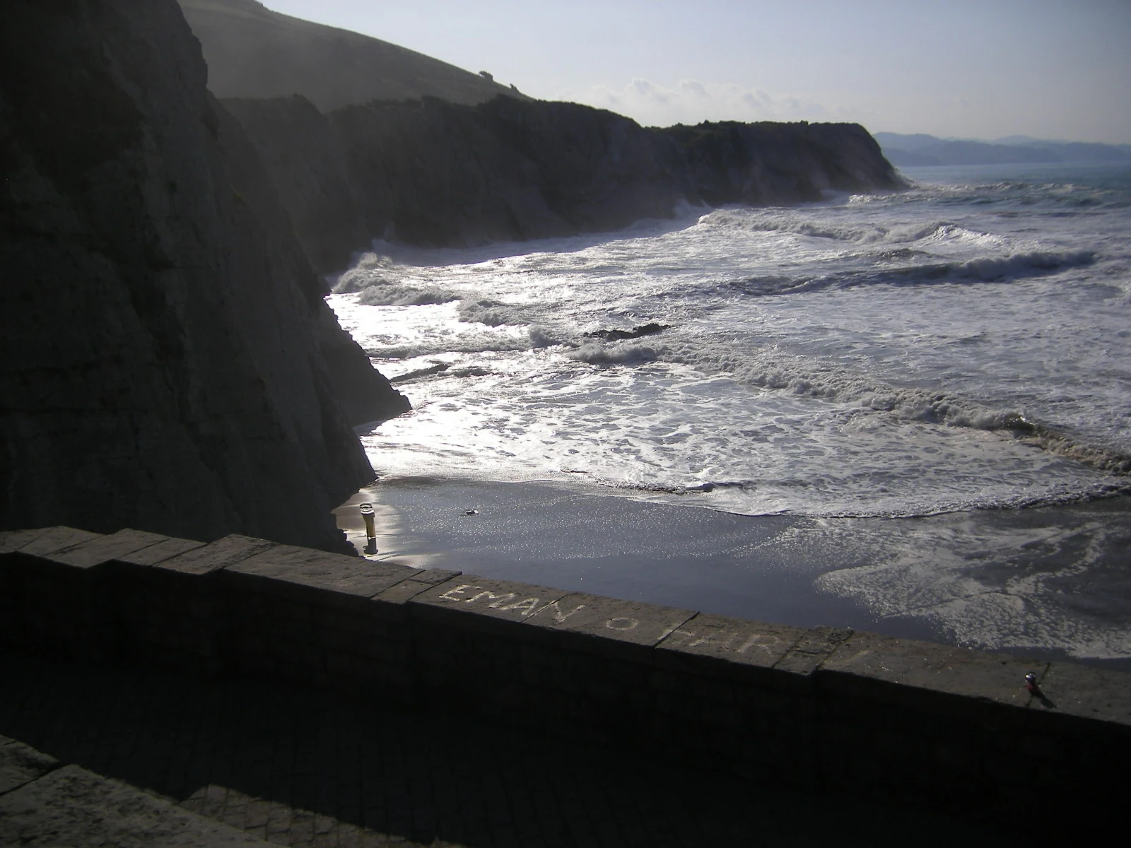
The intertidal platform appears at low tide and is home to pools, algae and invertebrates adapted to a changing environment. For precisely that reason, it should not be treated like an urban plaza: the coastal edge combines wet rock, uneven surfaces, waves and a rising tide that can cut off sections.
The geopark’s geological inventory states that entering the Algorri-Portutxiki tidal platform is not recommended. For most visitors, the best choice is to view it from the viewpoints or follow the marked paths. If an official activity includes the intertidal platform, follow the staff’s instructions and do not leave the group.
The cliffs can be very high and erosion remains active, especially during storms. Do not approach the edge, descend by shortcuts or cross coves while relying on intuition to judge the return. Before setting out, check the marine forecast, tide tables and any municipal or operational warnings.
Arrive without a car and set realistic accessibility expectations
Zumaia is connected by train to the Euskotren coastal line and also has bus services, making it possible to plan a visit without a private vehicle and combine some linear walks with public transport. The station, town centre, Itzurun and the start of the Algorri georoute make a reasonable day on foot, provided you allow the proper time for each section.
For Elorriaga, Sakoneta or a complete traverse, check the starting point, return journey and current timetables in advance. Do not assume that all trails are suitable for people with reduced mobility: there are natural surfaces, steps, slopes and exposed areas. Specific accessibility should be verified with the tourist office or the geopark according to the chosen route and individual needs.
As a responsible travel guideline, stay on marked routes, avoid disturbing pools and rocks, and let the interest of the area lie in observing its processes—sea, strata and intertidal life—without turning them into a surface to explore without planning.
References and checks before your trip
Stable information and geological context: UNESCO explains the geological value of the Basque Coast Global Geopark and the international significance of the Zumaia outcrop.
Routes and effort: Geoparkea publishes the georoutes, with indicative distances and durations for Elorriaga, Sakoneta, Lapari and Talaia.
Coastal setting and caution: Zumaia Tourism describes the Algorri cliffs, erosion dynamics and the ecosystem of the abrasion platform.
Mobility: Zumaia’s municipal information confirms the rail connections and directs visitors to the route planner; Euskotren maintains the official timetable search.
Before setting out, check train and bus timetables, the conditions for guided or maritime outings, trail conditions, weather warnings and the tide table. These details vary and should be confirmed in the official sources above on the day of your visit.
References consulted during editorial review. Times, requirements and advisories may change: always confirm with the official source.
- https://www.unesco.org/en/iggp/basque-coast-unesco-global-geopark?hub=67817 www.unesco.org
- https://geoparkea.eus/es/ geoparkea.eus
- https://www.unesco.org/en/iggp/igcp-projects/731 www.unesco.org
- https://geoparkea.eus/es/sobre-el-geoparque/contacto geoparkea.eus
- https://www.euskotren.eus/es/node/15156 www.euskotren.eus
- https://www.euskotren.eus/es/node/14529 www.euskotren.eus
- https://geoparkea.eus/site_media/pdf/Plan_de_Gesti%C3%B3n_2026.pdf geoparkea.eus
- https://geoparkea.eus/es/que-ver/geo-rutas geoparkea.eus
- España WikidataCC0 1.0 Wikidata · Q29
- España WikidataCC0 1.0 Wikidata · Q2565342
- España WikidataCC0 1.0 Wikidata · Q47450851
- España WikidataCC0 1.0 Wikidata · Q16254367
- Spain World Countries — mledozeODbL 1.0 World countries dataset by mledoze and contributors · ODbL 1.0
- Spain World Bank Open DataCC BY 4.0 World Bank
- Spain DBpediaCC BY-SA 3.0 DBpedia
- Evolución de la Industria del Turismo Sostenible en España OpenAlexCC0 1.0 OpenAlex
- TURISMO RURAL EN ESPAÑA: PAISAJES Y USUARIOS, NUEVOS USOS Y NUEVAS VISIONES OpenAlexCC0 1.0 OpenAlex
- Turismo pos-COVID-19: Reflexiones, retos y oportunidades OpenAlexCC0 1.0 OpenAlex
- Análisis de la oferta de turismo cultural en España OpenAlexCC0 1.0 OpenAlex
- HISTORIA DE ALGUNAS DENOMINACIONES DE TURISMO EN ESPAÑA: TURISMO DEPORTIVO, TURISMO CULTURAL, TURISMO MARINERO Y TURISMO GASTRONÓMICO CrossrefMetadatos públicos; derechos específicos por campo cuando correspondan Crossref
- Fuentes Vega, Alicia: Bienvenido, Mr Turismo. Cultura visual del boom en España. Madrid, Cátedra, 2017. 333 pp. CrossrefMetadatos públicos; derechos específicos por campo cuando correspondan Crossref
- Discontinuidades y limitaciones de los últimos planes turísticos de España en relación a la sostenibilidad ambiental del turismo de sol y playa CrossrefMetadatos públicos; derechos específicos por campo cuando correspondan Crossref
- Algorri, Alkiza, Gipuzkoa, Autonomous Community of the Basque Country, 20494, Spain OpenStreetMapODbL 1.0; atribución y obligación de compartir bases derivadas. Fuente: OpenStreetMap
- Algorri, Zumaia, Gipuzkoa, Autonomous Community of the Basque Country, 20750, Spain OpenStreetMapODbL 1.0; atribución y obligación de compartir bases derivadas. Fuente: OpenStreetMap
- Deba GeoNamesDatos geográficos bajo CC BY 4.0; requiere atribución a GeoNames. Fuente: GeoNames
- Deba GeoNamesDatos geográficos bajo CC BY 4.0; requiere atribución a GeoNames. Fuente: GeoNames
- Deba, Gipuzkoa, Autonomous Community of the Basque Country, Spain OpenStreetMapODbL 1.0; atribución y obligación de compartir bases derivadas. Fuente: OpenStreetMap