Estonia · Lahemaa National Park
Lahemaa by car: linking Viru, Altja and the northern coast
A realistic day trip from Tallinn combines an accessible bog, a coastal trail and a former fishing village—provided you accept that having a car greatly expands what you can see.
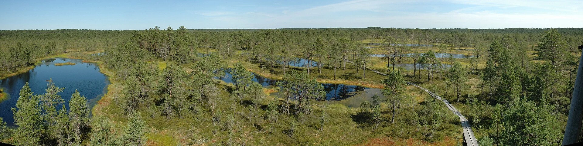
Lahemaa works best as a park of connected landscapes rather than a collection of quick stops. The Viru boardwalk offers an introduction to the bog without leaving the marked route; Altja adds coastline, pine forest and the traces of a fishing village. To connect both places in a single day, a car provides flexibility and coherence; by public transport, it is better to focus on Viru and travel with a much more limited plan.
Choose a full day or a short excursion
The practical decision comes before leaving Tallinn. By car, a sensible route links Viru bog, Altja and, if time allows, the paths around Oandu without turning the day into a race. These places are separated by local roads, not by a short, continuous walking route.
Without a car, Viru is the clearest option: the park information indicates a bus stop on the Tallinn–Rakvere road and an approximately 500-metre stretch to the start of the trail. It is a useful alternative for a visit focused on the bog, but not a realistic basis for adding Altja at a relaxed pace. Check the outbound itinerary and, above all, the final return connection before setting out: timetables and roadworks can change.
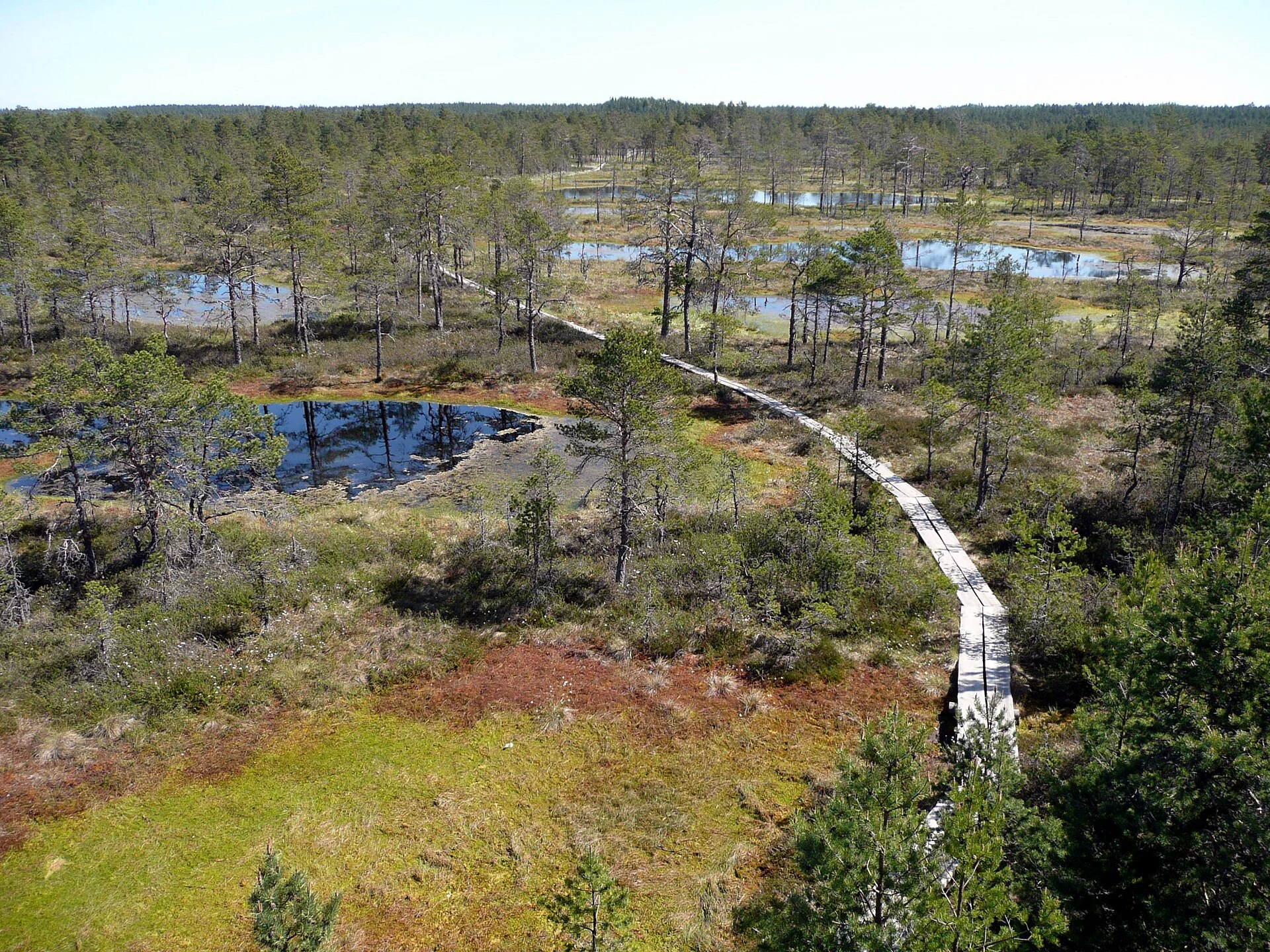
Viru bog: understanding a wetland from the boardwalk
The Viru trail crosses forest and bog via boardwalks and reaches an observation tower. The linear route between the two ends is 3.5 kilometres; returning along the forest track brings the circuit to 5.7 kilometres. From the new car park to the tower is 1.3 kilometres, a useful reference for anyone who wants to do only the most concentrated part of the visit.
There is no need to complete the entire circuit for the stop to be worthwhile. A slower pace helps you notice the pools, bog vegetation and transitions between pine forest and open ground. The route to the tower is described as suitable for a wheelchair user accompanied by someone else, and the tower’s first platform is too; this does not amount to guaranteed independent accessibility. Check the surface conditions, maintenance notices and weather on the day itself.
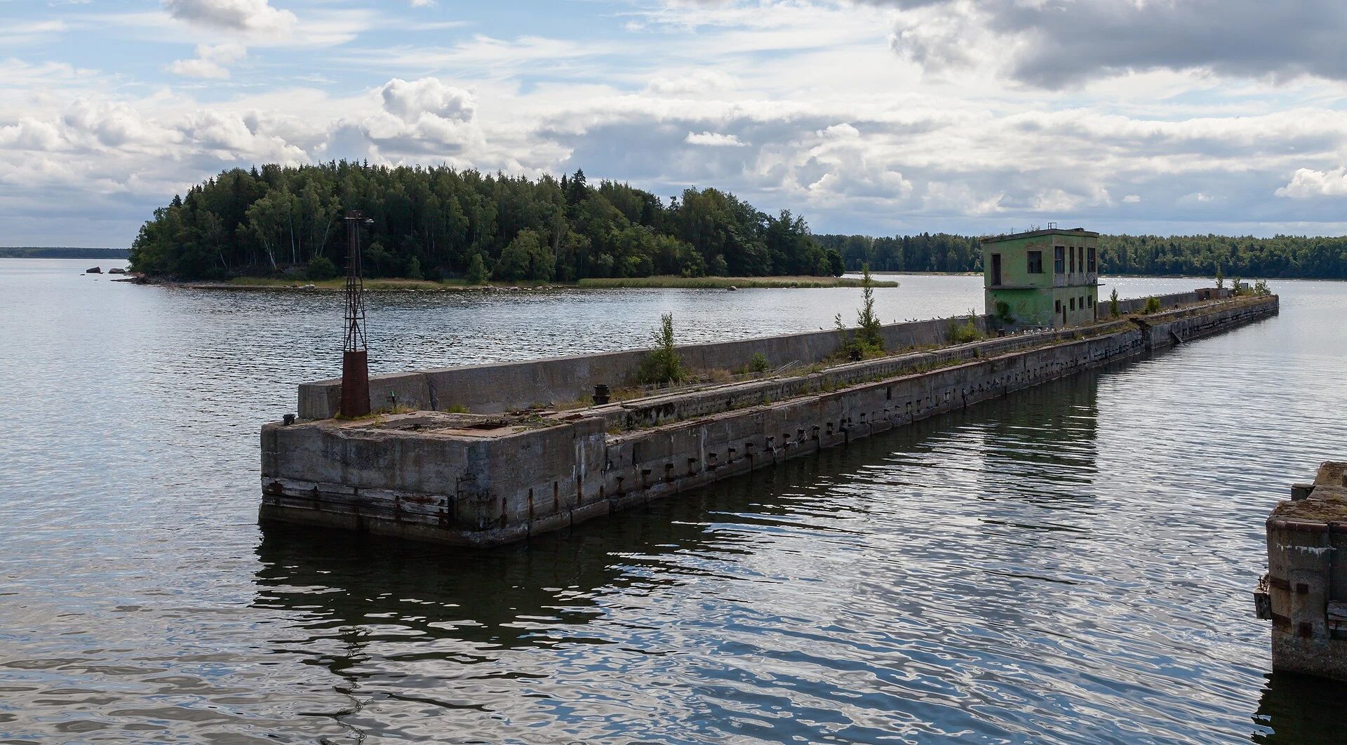
Altja: walking an inhabited coast with care
The Altja natural and cultural trail forms a circuit of about three kilometres from the centre of the village. It passes through coastal pine forest, the mouth of the Altja River, stony beaches and structures connected with the area’s fishing history. At the cape, you can see reconstructed boat sheds and fishing nets dating from the 1970s; they help place the historic relationship between coast, work and settlement, rather than serving as an isolated backdrop.
The appeal here lies in combining landscape and human scale. Follow the signs, and do not use yards, private entrances or residential areas as photographic shortcuts. The trail makes for a short walk, but the shoreline can be uneven and exposed to wind; shoes with good grip and a windproof layer are more useful choices than seeking technical equipment.
Visiting a park without increasing your footprint
The Viru boardwalks are more than a convenience: they protect wet, vulnerable ground. Stay on marked paths, take your waste with you and do not collect plants or disturb the bog pools. If you stop for a break, use the designated facilities and respect any restrictions that may apply to fires, camping, pets or conservation areas.
Lahemaa brings together nature and rural heritage, but that does not remove its limits. Slowing down is a practical way to care for the place: a long morning at Viru and an unhurried walk in Altja often offer more than adding numerous detours. If there are notices about partial closures, fire risk, animal disease or bad weather, adjust the route instead of looking for an alternative access point.
Sources to check before setting out
Changing details—boardwalk conditions, restrictions, accessibility, transport and services—should be confirmed before the visit using these official sources:
- Estonian State Forest Management Centre (RMK): trail information for Viru, the Altja circuit and nature conduct rules.
- Estonian Environmental Board: conservation guidance and regulations for Lahemaa National Park.
- Visit Estonia: general park-planning information and regional context.
- Estonia’s national public transport journey planner: current timetables to the Viru bog stop and return options.
For a day by car, also check navigation and road conditions the day before. For a car-free outing, do not assume that a connection available on an earlier date will still be operating.
References consulted during editorial review. Times, requirements and advisories may change: always confirm with the official source.
- https://rmk.ee/en/exploring-nature/where-to-go/viru-bog-nature-trails-observation-tower-1300-m-from-the-parking/ rmk.ee
- https://rmk.ee/en/exploring-nature/hiking-route/100-stories-from-the-hiking-route/1977-viru-bog-boardwalk-is-finished/ rmk.ee
- https://media.rmk.ee/files/K%C3%BCKa%20Lahemaa%20k%C3%BClastusala%20t%C3%B6%C3%B6versioon.pdf media.rmk.ee
- https://rmk.ee/en/recommendations-by-starting-point/ rmk.ee
- https://rmk.ee/looduses-liikumine/kuhu-minna/kalmeoja-lokkekoht/ rmk.ee
- https://rmk.ee/category/looduses-liikumine/kuhu-minna/rahvuspargid/lahemaa-rahvuspark/ rmk.ee
- https://visitestonia.com/en/where-to-go/lahemaa-national-park-estonia visitestonia.com
- https://rmk.ee/loodusope/geopeitus/lahemaa-rahvuspark/ rmk.ee
- Estonia WikidataCC0 1.0 Wikidata · Q191
- Estonia WikidataCC0 1.0 Wikidata · Q5401432
- Estonia WikidataCC0 1.0 Wikidata · Q17363906
- Estonia World Countries — mledozeODbL 1.0 World countries dataset by mledoze and contributors · ODbL 1.0
- Estonia World Bank Open DataCC BY 4.0 World Bank
- Estonia DBpediaCC BY-SA 3.0 DBpedia
- Lahemaa National Park GeoNamesDatos geográficos bajo CC BY 4.0; requiere atribución a GeoNames. Fuente: GeoNames
- Lahemaa National Park, Estonia OpenStreetMapODbL 1.0; atribución y obligación de compartir bases derivadas. Fuente: OpenStreetMap
- Altja GeoNamesDatos geográficos bajo CC BY 4.0; requiere atribución a GeoNames. Fuente: GeoNames
- Altja, Altja küla, Haljala vald, Lääne-Viru County, 45408, Estonia OpenStreetMapODbL 1.0; atribución y obligación de compartir bases derivadas. Fuente: OpenStreetMap