Algeria · architecture, Ibadi life and palm groves
M’Zab Valley visits begin with five ksour and local guidance
Ghardaïa, Beni Isguen, Melika, Bounoura and El Atteuf form a living urban landscape. The key is to organise your visit with a local guide, enough time and respect for local rules.
Conditions described in the guide: confirm current requirements and access with the official source before travelling.
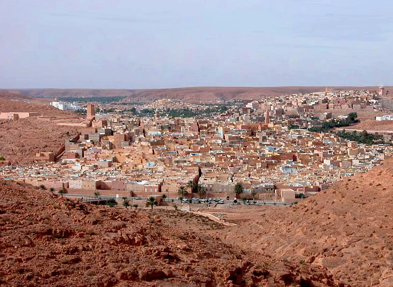
The M’Zab Valley is not a collection of ruins or a quick excursion from the desert: it brings together five inhabited ksour where architecture, domestic privacy and religious organisation still shape everyday life. Visiting properly also means looking at the palm-grove and water system, seeking local guidance and accepting that not every space or image is appropriate for visitors.
Ghardaïa, Melika, Beni Isguen, Bounoura and El Atteuf offer insight into a compact urban form developed by Ibadi communities from the Middle Ages onwards in a semi-arid environment. The reward lies not in collecting stops, but in understanding the role of each settlement and exploring it without mistaking living heritage for a tourist set.
Five ksour, one urban landscape
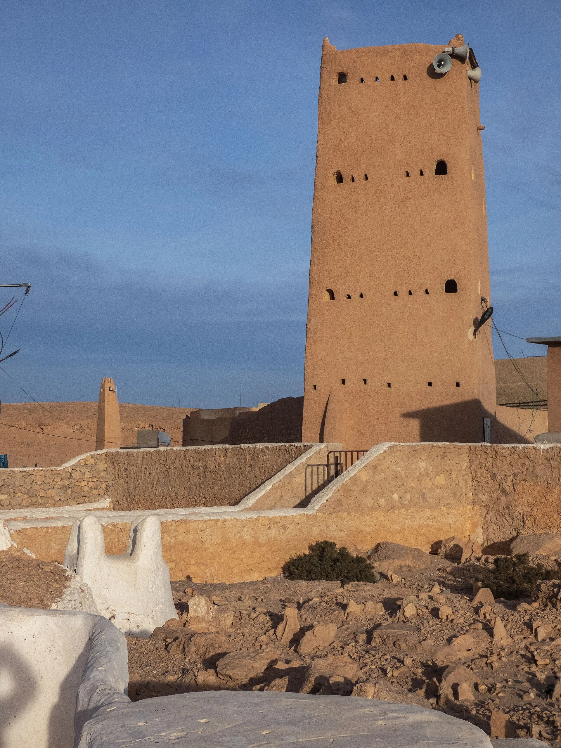
The ensemble is best understood as a network: the five historic ksour stand around the valley, with mosques dominating the higher ground, homes grouped together and palm groves in areas where water could sustain cultivation. The relationship between city and oasis matters as much as the façades: the palm groves, hydraulic infrastructure and watercourses are all part of the protected landscape.
Start by locating the settlements before deciding on your route. Ghardaïa offers the broadest urban scale; Beni Isguen has an organised visitor circuit; El Atteuf makes it possible to observe another form of ksar and palm-grove settlement. Melika and Bounoura complete the overall picture. Do not treat them as interchangeable neighbourhoods: they are communities with their own rhythms, access arrangements and uses.
The heritage designation specifically recognises the continuity between construction, community organisation and adaptation to the climate. It is therefore worth taking time to observe the street layout, the transitions between built-up areas and vegetation, and the logic of shade, rather than simply ticking off a list of isolated monuments.
Beni Isguen: seek local guidance before entering
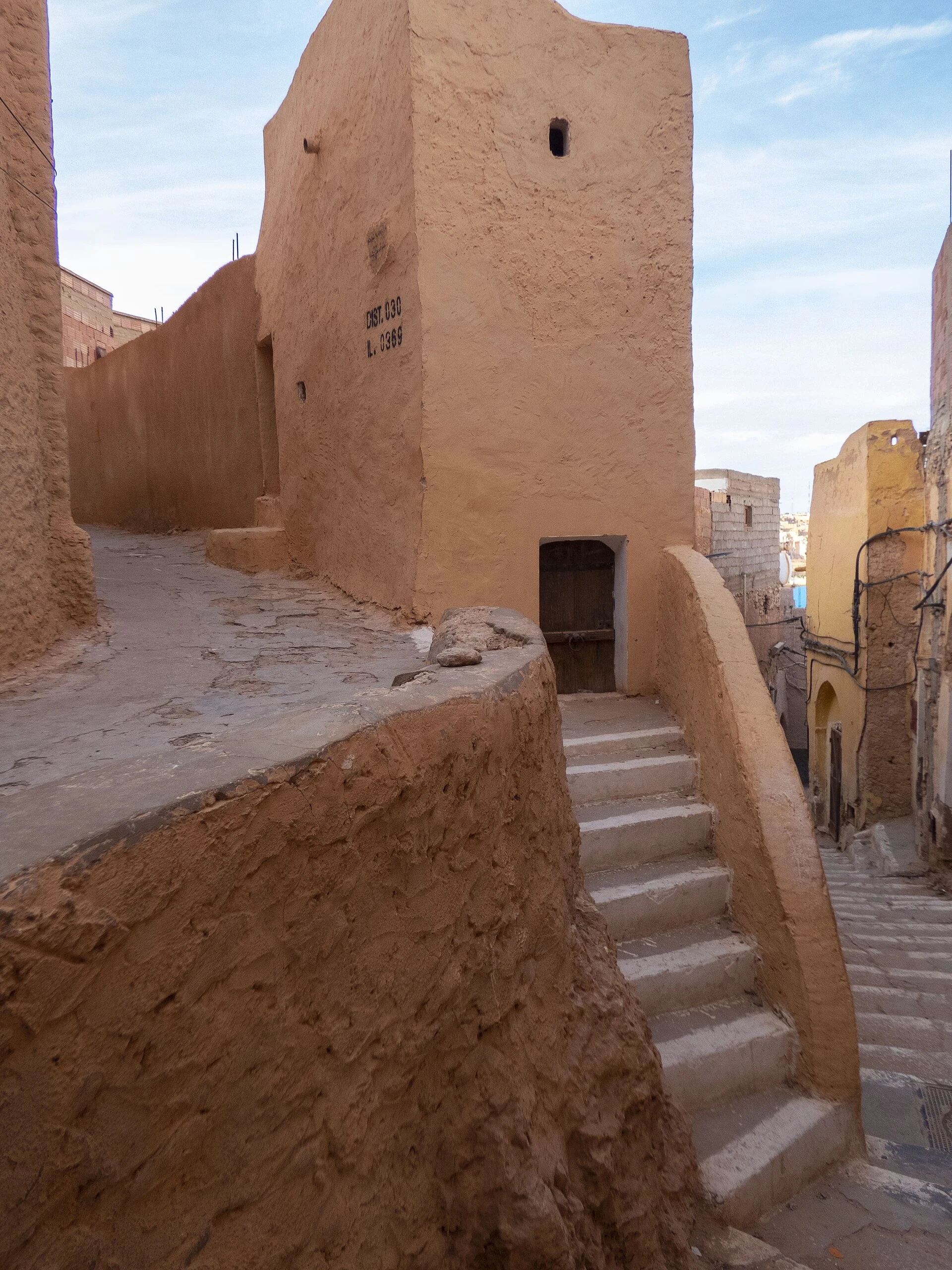
Beni Isguen is the clearest place to opt for an accompanied visit. At the eastern gate, a guide office explains the circuit and can lead visitors through the ksar’s narrow streets. Go to this information point first to avoid improvising in residential areas and to ask which sections are open that day.
The rules here are not cultural decoration. The local office asks visitors not to smoke, not to photograph passers-by and to dress discreetly, avoiding short or tight-fitting clothing. Photography requires particular care: ask before photographing people, doors, commercial activities or interiors, and accept a refusal without argument.
The route may include many steps and steep slopes towards the upper parts of the ksar. Anyone with reduced mobility, difficulty walking or little time should request a specific route, its duration and its changes in elevation in advance. Guide availability, routes and opening times should be confirmed before setting out.
The palm grove is not a photographic backdrop
In the M’Zab, the oasis embodies a way of managing a scarce resource. Systems for collecting and distributing floodwater made the palm groves possible and explain why the urban settlements cannot be understood separately from their agricultural surroundings. Water organises the landscape and helps explain the density of the ksour.
In Beni Isguen, a visit to the palm grove can be requested through the guides, but it depends on their availability. It is a good choice if your main interest is understanding the relationship between cultivation, wells, watercourses and the city, rather than architecture alone. Ask for the itinerary to interpret the hydraulic system, instead of treating the area as a simple scenic walk.
Keep your impact low: do not enter cultivated plots, use drones or operate imaging equipment without express permission, and do not assume that religious, domestic or funerary spaces are open to visitors. In an inhabited valley, the most responsible approach is to let local guidance determine where, when and how you visit.
Arrival, safety and decisions to settle beforehand
Ghardaïa has a civil airport, and the national airline maintains a flight-schedule search tool; timetables change, so check the current schedule before fixing accommodation or connections. For travel between the ksour, ask your accommodation or the local office for an up-to-date option, and do not assume that an itinerary found online is still operating.
Safety also requires a recent check. As a reference for US travellers, the advisory published on 3 September 2026 recommends exercising increased caution in Algeria and discourages travel to isolated desert areas without the support of an organised group. Do not extend your visit independently into remote Sahara routes; also consult the official advice issued for the country whose nationality you hold.
Before confirming a non-refundable trip, check entry requirements, safety advisories, weather conditions, the availability of a Beni Isguen guide and flight schedules. This is a sensible way to enjoy the valley with greater freedom to make decisions and less pressure on its communities.
Sources to check before setting out
Heritage and context: UNESCO’s World Heritage Centre, the Vallée du M’Zab entry and the site’s conservation documentation.
Guided visits and local rules: the Beni Isguen tourism and development office. Confirm the circuit, guide availability, opening times, holiday closures and the conditions for visiting the palm grove there.
Local information: the Ghardaïa Directorate of Tourism and Handicrafts and Algeria’s Ministry of Tourism and Handicrafts. Use them for local contacts and institutional guidance.
Flights and safety, variable information: Ghardaïa Airport, Air Algérie and the US Department of State’s official travel advisory. Check these resources immediately before booking and departing.
References consulted during editorial review. Times, requirements and advisories may change: always confirm with the official source.
- https://whc.unesco.org/en/list/188 whc.unesco.org
- https://whc.unesco.org/en/activities/768 whc.unesco.org
- https://travel.state.gov/en/international-travel/travel-advisories/algeria.html travel.state.gov
- https://whc.unesco.org/en/list/188/documents whc.unesco.org
- https://whc.unesco.org/en/list/188/maps/ whc.unesco.org
- https://whc.unesco.org/en/documents/109006 whc.unesco.org
- https://whc.unesco.org/document/5281 whc.unesco.org
- https://whc.unesco.org/document/137881 whc.unesco.org
- Argelia WikidataCC0 1.0 Wikidata · Q262
- Argelia WikidataCC0 1.0 Wikidata · Q2336241
- Argelia WikidataCC0 1.0 Wikidata · Q2142901
- Argelia WikidataCC0 1.0 Wikidata · Q2429884
- Argelia WikidataCC0 1.0 Wikidata · Q87249326
- Algeria World Countries — mledozeODbL 1.0 World countries dataset by mledoze and contributors · ODbL 1.0
- Algeria World Bank Open DataCC BY 4.0 World Bank
- Argelia DBpediaCC BY-SA 3.0 DBpedia
- Argelia DBpediaCC BY-SA 3.0 DBpedia
- Ghardaïa GeoNamesDatos geográficos bajo CC BY 4.0; requiere atribución a GeoNames. Fuente: GeoNames
- Ghardaia GeoNamesDatos geográficos bajo CC BY 4.0; requiere atribución a GeoNames. Fuente: GeoNames
- Ghardaia, 47000, Algeria OpenStreetMapODbL 1.0; atribución y obligación de compartir bases derivadas. Fuente: OpenStreetMap
- Ghardaia, Ghardaia District, Ghardaia, 47000, Algeria OpenStreetMapODbL 1.0; atribución y obligación de compartir bases derivadas. Fuente: OpenStreetMap
- Beni Isguen GeoNamesDatos geográficos bajo CC BY 4.0; requiere atribución a GeoNames. Fuente: GeoNames
- Beni Isguen, At Izjen, Bounoura, Bounoura District, Ghardaia, 47000, Algeria OpenStreetMapODbL 1.0; atribución y obligación de compartir bases derivadas. Fuente: OpenStreetMap
- BENI ISGUEN, Avenue 1 novembre;شارع 1 نوفمبر, Beni Isguen, At Izjen, Bounoura, Bounoura District, Ghardaia, 47005, Algeria OpenStreetMapODbL 1.0; atribución y obligación de compartir bases derivadas. Fuente: OpenStreetMap
- Bounoura GeoNamesDatos geográficos bajo CC BY 4.0; requiere atribución a GeoNames. Fuente: GeoNames
- Bounoura GeoNamesDatos geográficos bajo CC BY 4.0; requiere atribución a GeoNames. Fuente: GeoNames
- Bounoura, Bounoura District, Ghardaia, 47000, Algeria OpenStreetMapODbL 1.0; atribución y obligación de compartir bases derivadas. Fuente: OpenStreetMap
- Noumérat - Moufdi Zakaria Airport OpenFlightsODbL 1.0 (base de datos) / DbCL 1.0 (contenidos) Noumérat - Moufdi Zakaria Airport · OpenFlights · ODbL 1.0