La Rioja and San Juan, Argentina
Planning Separate Visits to Ischigualasto and Talampaya
Two adjoining parks, two visiting rhythms and one fossil basin: what changes between Ischigualasto and Talampaya, and how to plan your visit thoughtfully.
Conditions described in the guide: confirm current requirements and access with the official source before travelling.
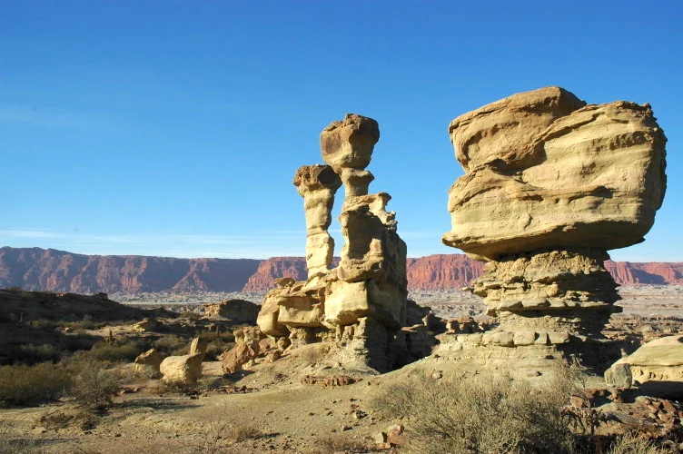
Ischigualasto and Talampaya form one vast geological archive, but they do not offer the same experience. The former is best understood through a vehicle circuit with brief stops among pale sediments and eroded forms; the latter focuses attention on a canyon of reddish walls, organized excursions and ancient traces of human presence. Planning them as one rushed outing erases that distinction. The key is to set aside time for two complementary landscapes and recognize that this is a dry-climate region where access depends on changing operating conditions.
A shared heritage best explored separately
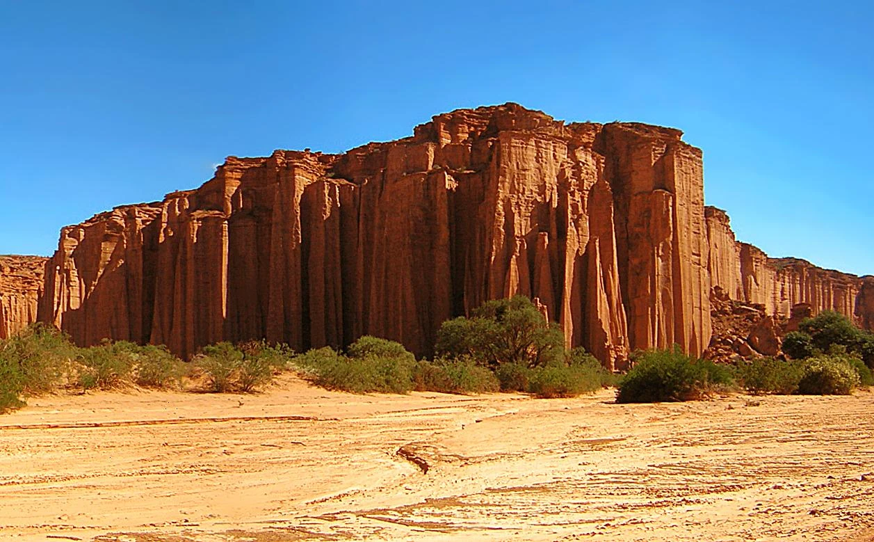
The two parks are adjacent and protect an exceptional sequence of Triassic sediments, a period that records decisive transformations in vertebrate life. This scientific continuity does not make the visits interchangeable: Ischigualasto emphasizes strata, landforms and fossils in an open landscape; Talampaya structures the experience around an excavated canyon, with red cliffs and a much more vertical scale.
The practical choice is simple: dedicate a full day or a generous time slot to each park. At Ischigualasto, the traditional circuit covers about 40 kilometres by vehicle, includes five stops and adds a visit to the Dr William Sill Site Museum. At Talampaya, access to the canyon is organized through excursions and authorized trails. Trying to connect both in just a few hours leaves little room for heat, wind, road delays or changes to departure times.
There is no need to chase a collection of formations with fanciful names. It is more rewarding to recognize that the colours, layers and silhouettes result from deposition, uplift and erosion. This perspective turns the visit from a catalogue of photographs into an approach to a protected fossil landscape.
Ischigualasto: the main circuit and the variants that demand real effort
The traditional daytime route is the most suitable option for a first visit: it is done by vehicle, lasts around three hours and does not require advance booking according to the official information currently available. Its advantage is that it covers several stations without turning the day into a long hike; its limitation is that time on foot is brief and dictated by the stops.
Visitors who want to walk have different alternatives. The Río Salado circuit combines a vehicle approach with a moderately difficult trek. The ascent of Cerro Morado reaches roughly 1,800 metres and is classified as physically and technically highly demanding; it requires a reservation and is not a light extension of the main circuit. There is also a mountain-biking option with a local guide, rated medium to high in difficulty.
Choose just one active variant in addition to the main circuit, not several. In an arid environment, exposure and the group’s pace matter more than the distance on paper. Carry enough water, sun protection, closed shoes and layers for temperature changes. Entry times, reservations and any restrictions due to heat or weather should be checked with park management before setting out.
Talampaya: the canyon requires logistics, not a freely improvised walk
At Talampaya, the Talampaya Canyon is not a self-guided trail to improvise. Authorized options include vehicle excursions, guided walks, cycling and combinations of these; choose according to the time available, your mobility and the type of landscape you want to observe.
The Nature and Culture excursion, included with park admission, visits the canyon’s initial sectors and has limited capacity. Longer experiences are available through authorized operators and guides, with different durations and levels of exertion. The canyon walk is advertised as low difficulty, while the Gran Mirador involves a longer day and considerable effort. Do not confuse low difficulty with an absence of exposure: desert terrain and a lack of shade remain important factors.
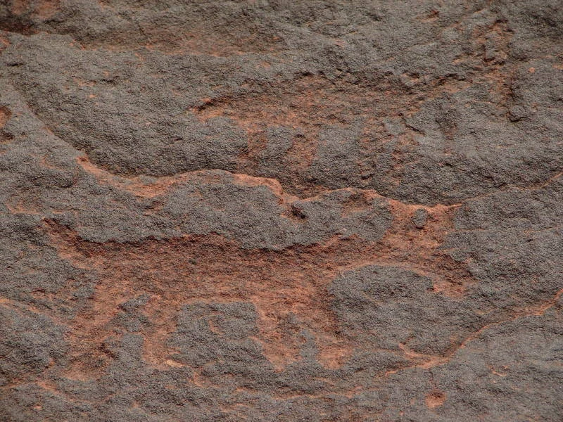
The petroglyph sites require special care. They are archaeological evidence, not a backdrop to interfere with: do not touch, trace, add marks or approach too closely. This helps keep the site legible. Conservation depends as much on formal controls as on the small gestures of every visitor.
Two decisions that can change the trip: transport and accessibility
Combining both parks works best with your own vehicle, a rental car or transport arranged in advance. There are paved-road approaches to Ischigualasto, but the official sources consulted do not support presenting the area as a car-free visit or guaranteeing useful public connections between circuits, entrances and accommodation. If you will not be driving, confirm exactly which transfers operate on your dates before booking lodging.
Talampaya offers an important detail for travellers with reduced mobility: its main service area and the canyon walkways are identified as accessible routes with assistance. This does not mean that every excursion, trail or access point in the park has the same conditions. Before arriving, ask about the assigned vehicle, the specific section, toilets, assistance and whether your chosen route can be completed.
Avoid relying on a single departure, too. Heavy rain, floods and the Zonda wind may alter or suspend excursions at Talampaya; at Ischigualasto, reservable variants depend on conditions at the start of the outing. Keeping one flexible night or a free morning is a prudent choice, not wasted time.
A responsible way to combine both parks
The best itinerary is not the one packed with the most activities, but the one that allows you to understand why both places are protected. Spend the first day at Ischigualasto and its site museum; use the second for Talampaya, choosing an excursion that matches your energy and the available light. If you have time for only one, choose Ischigualasto for a broad view of the basin, and Talampaya for the scale of the canyon, guided walks and petroglyphs.
Stay on authorized routes, and do not remove stones or fossils or feed wildlife. Fossils are not transportable souvenirs: their scientific value depends on remaining connected to their stratum and discovery site. The visit gains depth when this limit is accepted: observing without extracting is part of understanding the Triassic.
Before travelling, check with the official bodies listed below for road access, current fees, opening hours, capacity limits, available excursions, booking requirements and any weather or operational alerts.
References to check before you go
- Argentina’s National Parks Administration, visitor information for Talampaya National Park: access, seasonal opening hours, possible suspensions and services.
- Argentina’s National Parks Administration, authorized operators in Talampaya: excursion options in the canyon and Los Balcones.
- Ischigualasto Provincial Park, official circuits: daytime route, Cerro Morado, Río Salado, cycling and booking conditions.
- Ischigualasto Provincial Park, official access guidance via National Route 150 and Provincial Route 510.
- UNESCO World Heritage Centre, Ischigualasto/Talampaya Natural Parks entry: paleontological value, area and inscription criteria.
References consulted during editorial review. Times, requirements and advisories may change: always confirm with the official source.
- https://whc.unesco.org/en/list/966 whc.unesco.org
- https://whc.unesco.org/en/decisions/2424 whc.unesco.org
- https://whc.unesco.org/en/statesparties/ar whc.unesco.org
- https://whc.unesco.org/document/1140 whc.unesco.org
- https://whc.unesco.org/en/list whc.unesco.org
- https://whc.unesco.org/uploads/nominations/966.pdf whc.unesco.org
- https://whc.unesco.org/en/list/966/indicators/ whc.unesco.org
- https://www.ischigualasto.gob.ar/?page_id=1675 www.ischigualasto.gob.ar
- Argentina WikidataCC0 1.0 Wikidata · Q414
- Argentina WikidataCC0 1.0 Wikidata · Q4789276
- Argentina WikidataCC0 1.0 Wikidata · Q3622264
- Argentina WikidataCC0 1.0 Wikidata · Q37498453
- Argentina WikidataCC0 1.0 Wikidata · Q83645577
- Argentina World Countries — mledozeODbL 1.0 World countries dataset by mledoze and contributors · ODbL 1.0
- Argentina World Bank Open DataCC BY 4.0 World Bank
- Argentina DBpediaCC BY-SA 3.0 DBpedia
- Sobre José Zanca, Catolicismo y cultura de izquierda en la Argentina del siglo XX CrossrefMetadatos públicos; derechos específicos por campo cuando correspondan Crossref
- Sobre la historia de la cultura en Argentina CrossrefMetadatos públicos; derechos específicos por campo cuando correspondan Crossref
- Miradas antagónicas del turismo en Argentina, una revisión sobre Bariloche y las guías de turismo del peronismo (1945-1955) CrossrefMetadatos públicos; derechos específicos por campo cuando correspondan Crossref
- Literatura Argentina Open LibraryCC0 1.0 (registros de catálogo) Open Library
- Alfajor de Dulce de Leche Open Food FactsODbL 1.0 Open Food Facts
- Alfajor de Dulce de Leche Blanco Open Food FactsODbL 1.0 Open Food Facts
- Ischigualasto Provincial Park GeoNamesDatos geográficos bajo CC BY 4.0; requiere atribución a GeoNames. Fuente: GeoNames
- Ischigualasto Provincial Park, Valle Fértil, San Juan, Argentina OpenStreetMapODbL 1.0; atribución y obligación de compartir bases derivadas. Fuente: OpenStreetMap
- Talampaya National Park GeoNamesDatos geográficos bajo CC BY 4.0; requiere atribución a GeoNames. Fuente: GeoNames
- Talampaya National Park, Departamento Independencia, La Rioja, F5386, Argentina OpenStreetMapODbL 1.0; atribución y obligación de compartir bases derivadas. Fuente: OpenStreetMap