New Zealand · North Island
Whanganui Journey by canoe on a river that demands self-reliance
Paddling down the Whanganui River rewards preparation: choose your section, assess the crew’s real experience and travel mindfully on an *awa* with deep living significance.
Conditions described in the guide: confirm current requirements and access with the official source before travelling.
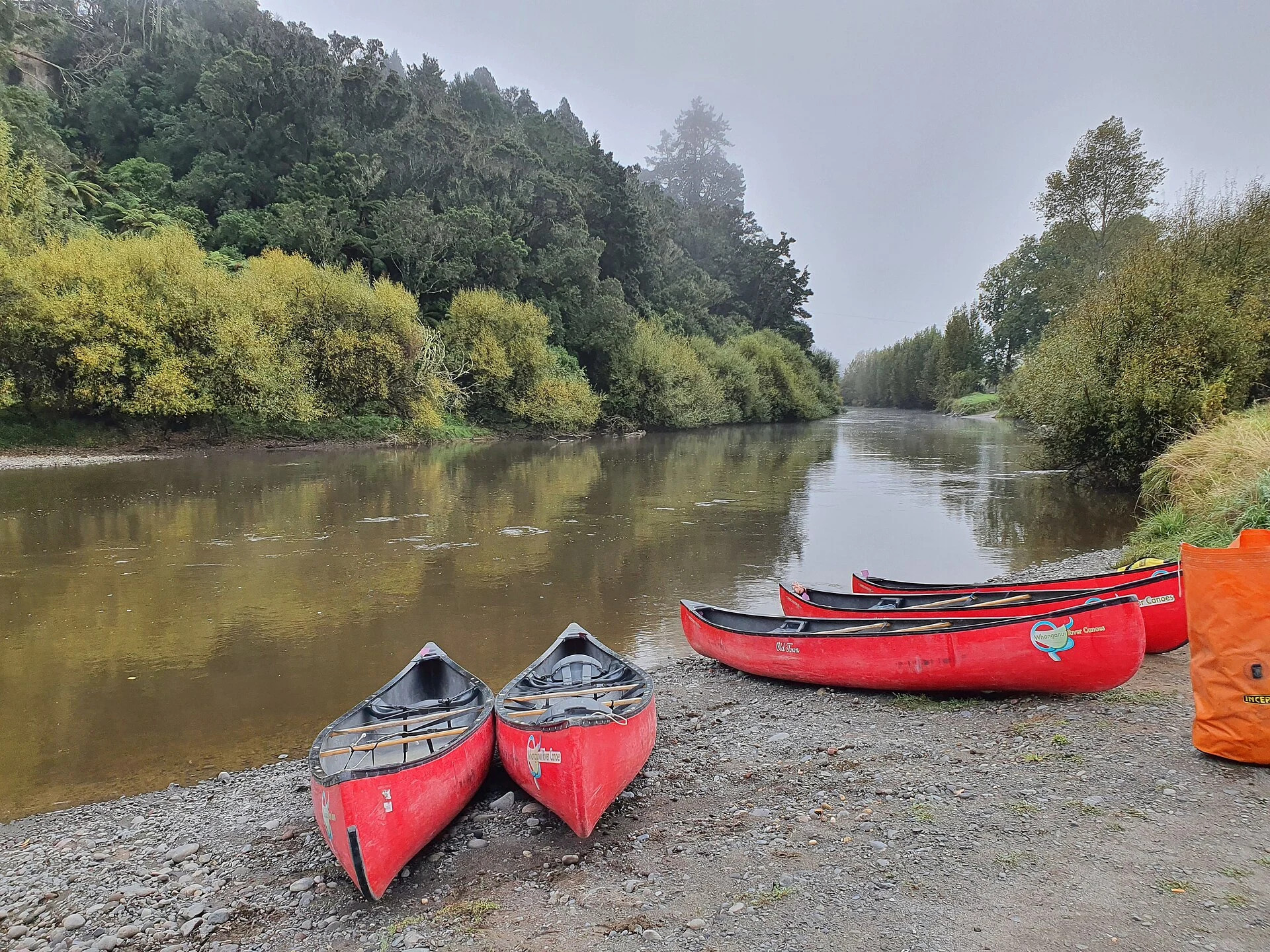
The Whanganui Journey is not a river outing to improvise: it is a multi-day canoe trip through gorges, rapids and remote campsites on the North Island. The most important decision comes before launching: distinguish between the full and shorter sections, accept the sustained effort involved and understand that Te Awa Tupua is visited as a river with its own cultural and legal connections, not as a natural backdrop.
Choosing the section changes the entire trip
The full route runs 145 km from Taumarunui to Pipiriki and usually takes about five days. For those with less time, the section from Whakahoro to Pipiriki covers 88 km and is generally completed in three days. They are not equivalent: the longer route requires more days of self-sufficiency, while the shorter section begins amid the gorge scenery.
Distance is not the only useful reference. Some stages involve six to nine hours of paddling, and low water levels can make them longer. Whakahoro is the last road access before Pipiriki; from there, the scope for changing the plan becomes limited. If the group has no canoeing experience, anyone in it is not a confident swimmer, someone is travelling alone or the crew cannot maintain a sustained pace, consider a guided trip or a partial jet-boat excursion rather than forcing an independent descent.
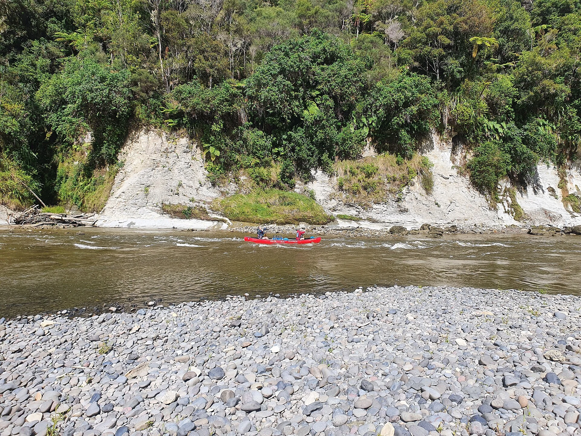
The river sets the schedule, not the booking
During the Great Walks season, huts and campsites require advance reservations; outside it, they operate on a first-come, first-served basis. This affects both the itinerary and the flexibility to change an overnight stop. Check the current season, availability and conditions before arranging transport or rentals: these details can change.
Rain upstream can raise the river even when it is not raining at the campsite. A rise in water levels means stopping and waiting, which is why carrying extra food, warm quick-drying clothing and a way to treat drinking water is not excessive caution. On the water, life jackets must be worn, luggage should be properly secured and it is wise to reach each stop in daylight. There is no reliable mobile coverage along the route: an emergency beacon is a sensible extra layer of preparation, not permission to paddle in a poor forecast.

The Bridge to Nowhere detour deserves its own pace
The return walk to Bridge to Nowhere begins at Mangapurua Landing: it is 3 km and takes around an hour and a half, with the route shared by cyclists. The bridge is a surviving piece of the former agricultural settlement in the Mangapurua Valley; its interest lies in the relationship between infrastructure, rural colonisation and abandonment, not in turning the stop into a race for a photograph.
The landing can be slippery when the rock is wet and may become crowded with canoes and boats. Treat the walk as part of a long day of paddling, allow time to secure the canoe and return to the river without rushing, and do not regard it as compulsory if the water level, time or fatigue makes getting out unwise.
Travelling on Te Awa Tupua involves protocol and limits
New Zealand law recognises Te Awa Tupua—the Whanganui River—as a legal entity. For visitors, the practical consequence is not learning a slogan but acting with situated respect: read the cultural guidance before setting out, do not enter Tamatea’s Cave, identified as a wāhi tapu, or sacred place, and follow the protocol at Tīeke Kāinga, which is both a functioning marae and an overnight site.
Keep soap and detergents out of the river, use the available toilets, remove all waste and camp only in designated places. Avoiding alcohol and tobacco on the awa and at Tīeke Kāinga reflects both safety and cultural consideration. The experience is better when the group agrees on these rules before loading the canoes: self-reliance does not mean occupying the river without responsibilities.
Official sources to check before setting out
Review the following resources again when finalising the trip, especially for bookings, river levels, weather, road conditions and operational notices.
- New Zealand’s Department of Conservation: planning the Whanganui Journey, requirements for independent navigation, stages, huts, campsites and safety.
- New Zealand legislation: the legal recognition of Te Awa Tupua and the framework governing the relationship with the Whanganui River.
- Horizons Regional Council: environmental data and monitoring of river and rainfall levels in the region.
- Manawatū-Whanganui Emergency Management: public alerts and guidance in the event of flooding.
References consulted during editorial review. Times, requirements and advisories may change: always confirm with the official source.
- https://www.doc.govt.nz/whanganuijourney www.doc.govt.nz
- https://www.legislation.govt.nz/act/public/2017/7/en/latest/sections/DLM6830862/ www.legislation.govt.nz
- https://www.legislation.govt.nz/act/public/2017/7/en/latest/sections/DLM6831554/ www.legislation.govt.nz
- https://www.legislation.govt.nz/act/public/2017/7/en/latest/sections/DLM6830851/DLM6831774 www.legislation.govt.nz
- https://www.legislation.govt.nz/act/public/2025/5/en/latest/sections/LMS890792/DLM6831508 www.legislation.govt.nz
- https://www.legislation.govt.nz/act/public/2026/2/en/2026-02-09B.pdf www.legislation.govt.nz
- https://www.legislation.govt.nz/act/public/2017/7/en/2017-03-20/ www.legislation.govt.nz
- https://dxcprod.doc.govt.nz/news/media-releases/2026-media-releases/ready-set-naturing-doc-great-walk-hut-and-campsite-bookings-open-from-12-may/ dxcprod.doc.govt.nz
- Nueva Zelanda WikidataCC0 1.0 Wikidata · Q664
- Nueva Zelanda WikidataCC0 1.0 Wikidata · Q99292883
- Nueva Zelanda WikidataCC0 1.0 Wikidata · Q20288890
- New Zealand World Countries — mledozeODbL 1.0 World countries dataset by mledoze and contributors · ODbL 1.0
- New Zealand World Bank Open DataCC BY 4.0 World Bank
- turismo regenerativo en la planificación turística regional de Nueva Zelanda OpenAlexCC0 1.0 OpenAlex
- turismo regenerativo en la planificación turística regional de Nueva Zelanda CrossrefMetadatos públicos; derechos específicos por campo cuando correspondan Crossref
- Turismo cinematográfico en Nueva Zelanda: Hobbiton Movie Set como estrategia inversa CrossrefMetadatos públicos; derechos específicos por campo cuando correspondan Crossref
- Desempeño relativo de la productividad física de la ganadería de Nueva Zelanda y Uruguay, 1870-2010. ANEXO CrossrefMetadatos públicos; derechos específicos por campo cuando correspondan Crossref
- Desempeño relativo de la productividad física de la ganadería de Nueva Zelanda y Uruguay, 1870-2010 CrossrefMetadatos públicos; derechos específicos por campo cuando correspondan Crossref
- Copa mundial femenina de la FIFA Australia-Nueva Zelanda 2023. Un análisis de la mediatización de la selección femenina argentina en el portal digital TyCSports CrossrefMetadatos públicos; derechos específicos por campo cuando correspondan Crossref
- Nueva Zelanda CrossrefMetadatos públicos; derechos específicos por campo cuando correspondan Crossref
- Whanganui River GeoNamesDatos geográficos bajo CC BY 4.0; requiere atribución a GeoNames. Fuente: GeoNames
- Taumarunui GeoNamesDatos geográficos bajo CC BY 4.0; requiere atribución a GeoNames. Fuente: GeoNames
- Taumarunui GeoNamesDatos geográficos bajo CC BY 4.0; requiere atribución a GeoNames. Fuente: GeoNames
- Taumarunui, Ruapehu District, Manawatū-Whanganui, 3920, New Zealand OpenStreetMapODbL 1.0; atribución y obligación de compartir bases derivadas. Fuente: OpenStreetMap
- Pipiriki GeoNamesDatos geográficos bajo CC BY 4.0; requiere atribución a GeoNames. Fuente: GeoNames
- Pipiriki GeoNamesDatos geográficos bajo CC BY 4.0; requiere atribución a GeoNames. Fuente: GeoNames
- Pipiriki, Ruapehu District, Manawatū-Whanganui, New Zealand OpenStreetMapODbL 1.0; atribución y obligación de compartir bases derivadas. Fuente: OpenStreetMap