Bhutan · Punakha Valley
Punakha along the Mo Chhu to Khamsum Yulley
A day linking the dzong beside two rivers, a climb through cultivated fields and a temple best visited with time and respect.
Conditions described in the guide: confirm current requirements and access with the official source before travelling.
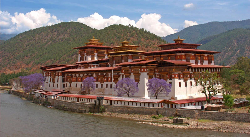
Punakha is best understood through a specific relationship: that between the Pho Chhu and Mo Chhu rivers, the religious buildings, the cultivated fields and the valley’s monastic life. This is not a stop for simply stringing together photographs: it offers a cultural walking route combining Punakha Dzong with the climb to Khamsum Yulley Namgyal Chorten. The contrast matters: first, a major religious and administrative centre at the confluence of two rivers; then, a short but steep walk ending above the rice fields.
Start at the dzong to understand the valley
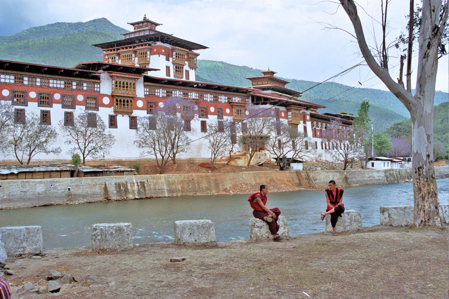
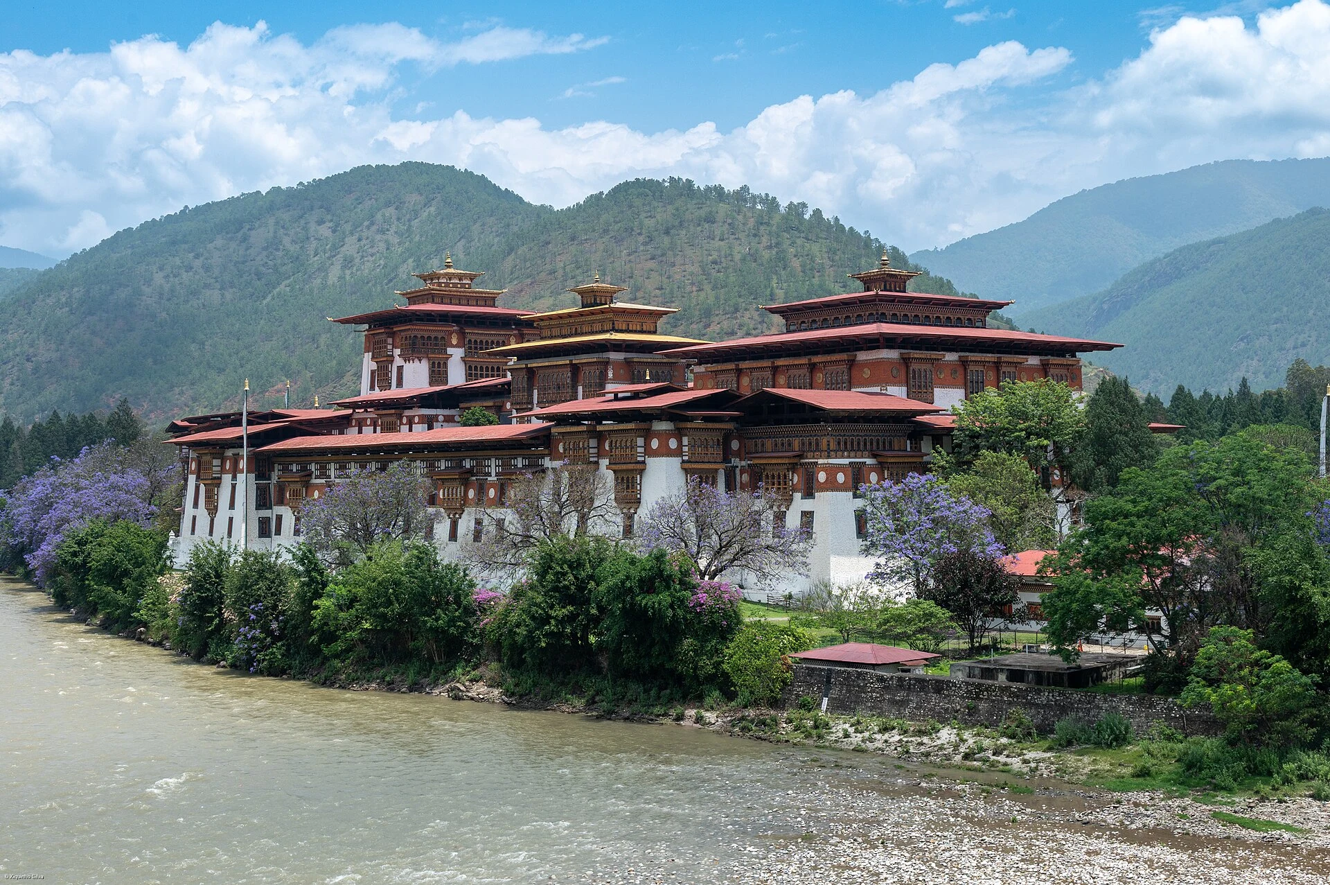
Punakha Dzong was built in 1637–1638 and stands at the confluence of the Pho Chhu and Mo Chhu; after joining, the two form the Puna Tsang Chhu. This location helps you read it as more than a monument: it remains the district administrative centre and winter residence of the central monastic body.
Use your first visit to take in the scale of the complex, its courtyards and its direct relationship with the water. The dzong appears on Bhutan’s tentative list for World Heritage, not on the List of Inscribed World Heritage Sites: a useful distinction when interpreting its value without assigning it a status it does not have.
Check before you go the day’s access arrangements, opening hours, fees and the current guide requirement for entering dzongs. Wear clothing covering your shoulders and legs, remove your shoes when requested and assume that indoor photography may be restricted.
The climb to Khamsum: short in distance, demanding in gradient
From the Kabisa area, the route to Khamsum Yulley Namgyal Chorten crosses a suspension bridge over the Mo Chhu and continues along the edges of cultivated fields before gaining height. Official tourism information estimates around two hours there and back; it is not a major hike, but you should allow time for the gradient, the heat and the chorten’s narrow stairways.
The practical decision is simple: do it if you can walk uphill at a steady pace and climb stairs without rushing. If not, make the dzong and the valley the core of your day; the visit is not incomplete if you skip the viewpoint. Good-grip footwear, reusable water and a light layer are more useful than trying to speed up the ascent.
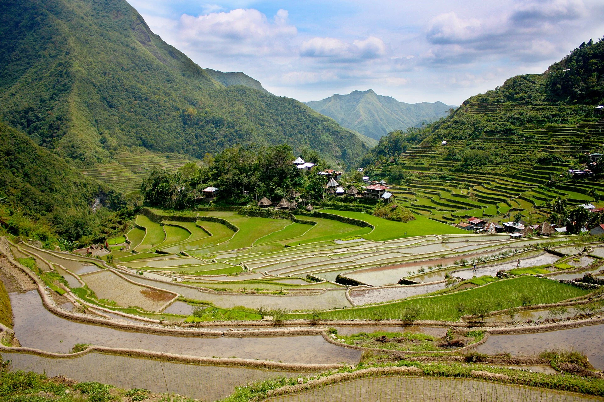
The rice fields are neither a park nor a backdrop. Stay on the path, do not enter plots in search of a better frame and let people working or travelling along the trail pass. The walk crosses a productive landscape, not an empty space.
A contemporary chorten with a precise religious purpose
Khamsum Yulley Namgyal Chorten was commissioned by Queen Mother Ashi Tshering Yangdon Wangchuck and consecrated in 2004 with an intention of promoting peace and harmony. Its tiered exterior, the protective figures inside and the upper terrace are best understood as parts of a ritual building rather than simply as viewpoint features.
Enter calmly, avoid touching paintings or religious objects and do not block the way for people who are praying. Inside and on the stairs, space is limited: let the religious visit set the pace. The broad view over the Mo Chhu at the end of the climb is a worthwhile conclusion, but it does not replace paying attention to the building or the valley you have crossed.
Add Chimi Lhakhang only if you want another perspective on the valley
Chimi Lhakhang, near Lobesa, offers a different extension for a second half-day. The monastery was founded in 1499 and is associated with Drukpa Kunley, a figure known for his unconventional religious teaching. The final route from the village runs through farmland and ends on a small rise.
Its phallic iconography and fertility-related blessings may arouse curiosity, but they are no reason to turn the visit into a joke or photograph other people without asking permission. Listen to your guide’s explanation first and decide whether this context matches your interests. If you prefer to stay focused, Punakha Dzong and Khamsum are a coherent day on their own.
Planning that prevents a rushed visit
Punakha works best as a pause within an itinerary through western Bhutan rather than as a succession of stops made from a vehicle. Group the dzong and Khamsum on the same day, leaving room for changes in access, rain, ceremonies or a slower-than-expected climb. If you include Chimi Lhakhang, add another block of time instead of compressing all three visits.
Check before booking the visa or permit conditions that apply to your nationality, the applicable tourist fee, guide requirements and the entry rules for monuments. Also confirm with the local administration or your accommodation the condition of the paths and any temporary closures. These are operational details that may change and should not be treated as permanent information.
References to check before travelling
- Bhutan Travel: official information on Punakha, visits, visas and frequently asked questions; entry requirements, tourist fees, etiquette at religious sites and the need for a guide at dzongs.
- Punakha Dzongkhag Administration: official pages on Punakha Dzong, Khamsum Yulley Namgyal Chorten and Chimi Lhakhang; history, location and visit details.
- UNESCO World Heritage Centre: Bhutan’s tentative list and the entry for the dzong group.
References consulted during editorial review. Times, requirements and advisories may change: always confirm with the official source.
- https://whc.unesco.org/en/search/?category=Tentative+Lists&criteria=Over+Head+Construction+Manual+27.2&maxrows=200 whc.unesco.org
- https://whc.unesco.org/en/tentativelists/action%3Dlisttentative%26order%3Dstates%26state%3Dbt whc.unesco.org
- https://whc.unesco.org/en/search/?category=Tentative+Lists&criteria=Over+Head+Construction+Manual+27.2 whc.unesco.org
- https://whc.unesco.org/en/search/?category=Tentative+Lists&criteria=1476+27%3D&maxrows=171 whc.unesco.org
- https://whc.unesco.org/en/search/?category=Tentative+Lists&criteria=je+9 whc.unesco.org
- https://whc.unesco.org/en/search/?category=Tentative+Lists&criteria=Department+29&maxrows=200 whc.unesco.org
- https://whc.unesco.org/en/search/?FORM=ANNTA0&PC=LCTS&adlt=strict&adppc=EDGEXST&category=Tentative+Lists&criteria=83e4765be2d43e3f252186e&gs_lcrp=EgRlZGdlKgkIturkeyABBFGDsY-QcyCQgAEEUYOxj5BzIGCAEQLhhAMgYIAhBFGDsyBggDEAAYQDIGCAQQABhAMgYIBRAAGEAyBggGEEUYPDI whc.unesco.org
- https://whc.unesco.org/en/search/?category=Tentative+Lists&criteria=27SAT28 whc.unesco.org
- Bután WikidataCC0 1.0 Wikidata · Q917
- Bhutan World Countries — mledozeODbL 1.0 World countries dataset by mledoze and contributors · ODbL 1.0
- Bhutan World Bank Open DataCC BY 4.0 World Bank
- El Índice de la Felicidad Nacional Bruta como complemento ante las limitaciones de los modelos socio-económicos tradicionales: El caso del Reino de Bután OpenAlexCC0 1.0 OpenAlex
- Punakha GeoNamesDatos geográficos bajo CC BY 4.0; requiere atribución a GeoNames. Fuente: GeoNames
- Punakha, Changyuel Loongsilgang Tashijong, Guma Gewog, Punakha District, 13001, Bhutan OpenStreetMapODbL 1.0; atribución y obligación de compartir bases derivadas. Fuente: OpenStreetMap
- Punakha Dzong, Punakha Cantilever Bridge, Yebisa, Chhuboog Gewog, Punakha District, 13001, Bhutan OpenStreetMapODbL 1.0; atribución y obligación de compartir bases derivadas. Fuente: OpenStreetMap
- Pho Chhu GeoNamesDatos geográficos bajo CC BY 4.0; requiere atribución a GeoNames. Fuente: GeoNames