Southern Alberta, Canada
Áísínai’pi and the Rock Art of the Milk River Valley
At Writing-on-Stone, the important decision is not how many viewpoints to collect, but whether to choose an independent approach to the landscape or a guided visit to the protected rock art.
Conditions described in the guide: confirm current requirements and access with the official source before travelling.
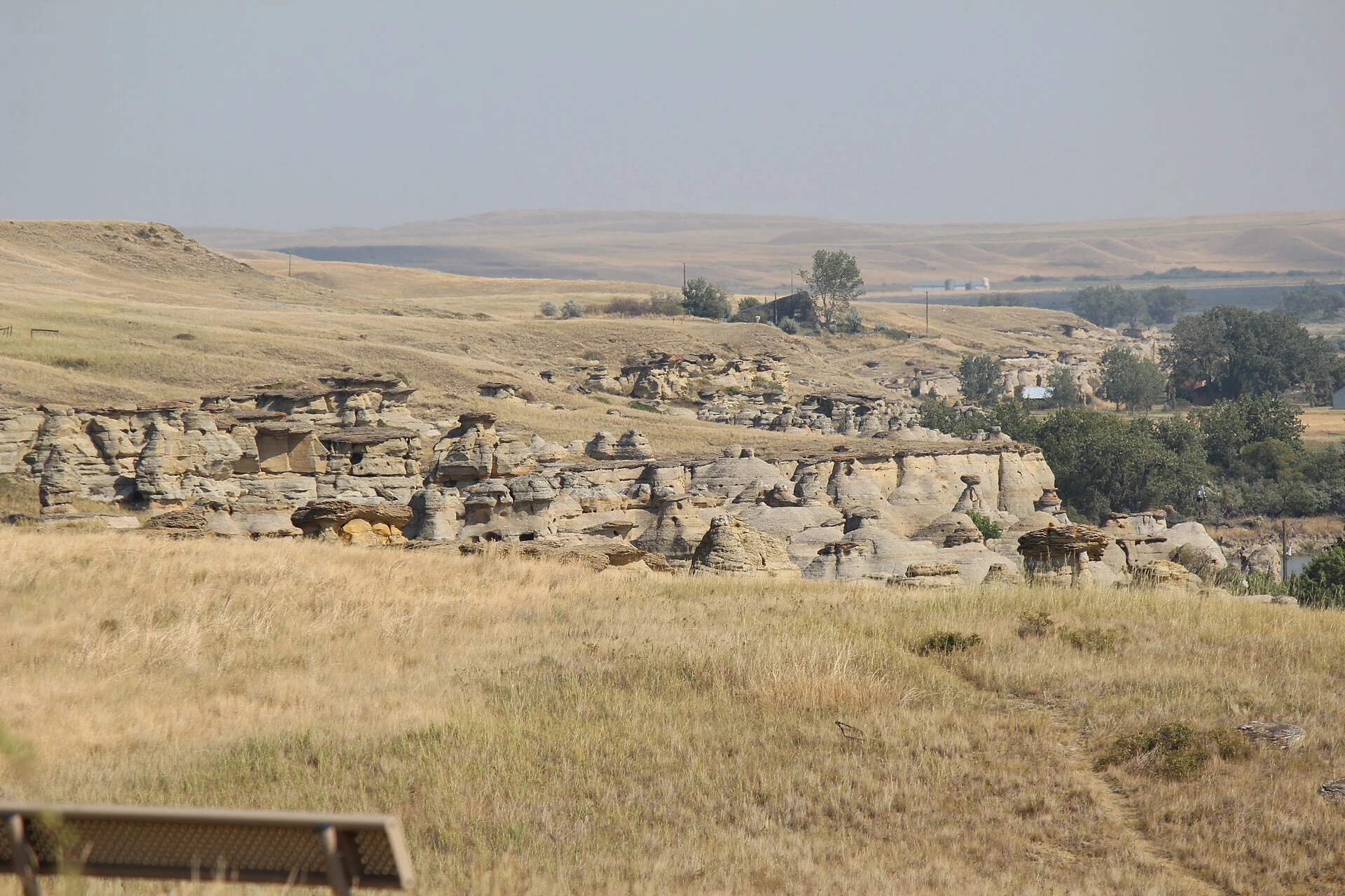
Áísínai’pi, also known as Writing-on-Stone Provincial Park, brings together engraved and painted sandstone cliffs, hoodoos, grassland and the Milk River valley in southern Alberta. It is a sacred cultural landscape for the Niitsítapi, or Blackfoot peoples: a visit becomes more meaningful when you understand that the rock art is inseparable from the formations, the river and the living practices connected with the place. The key practical decision is to distinguish what you can explore independently from what calls for a guided interpretive visit.
First a landscape, then the images
Áísínai’pi should not be treated as an outdoor gallery. Petroglyphs and pictographs appear amid sandstone cliffs, ravines and eroded pillars that are themselves part of the site’s cultural meaning. Some images record events and historical changes; others relate to Niitsítapi spiritual traditions. Taking in the valley as a whole before looking for details in the rock helps avoid a purely decorative reading.
Start at the visitor centre: its exhibitions and viewpoint provide context, and self-guided trails begin there. This is a good option if you have little time or prefer to walk at your own pace, but it does not replace the context provided by specialist interpretation of the rock art.
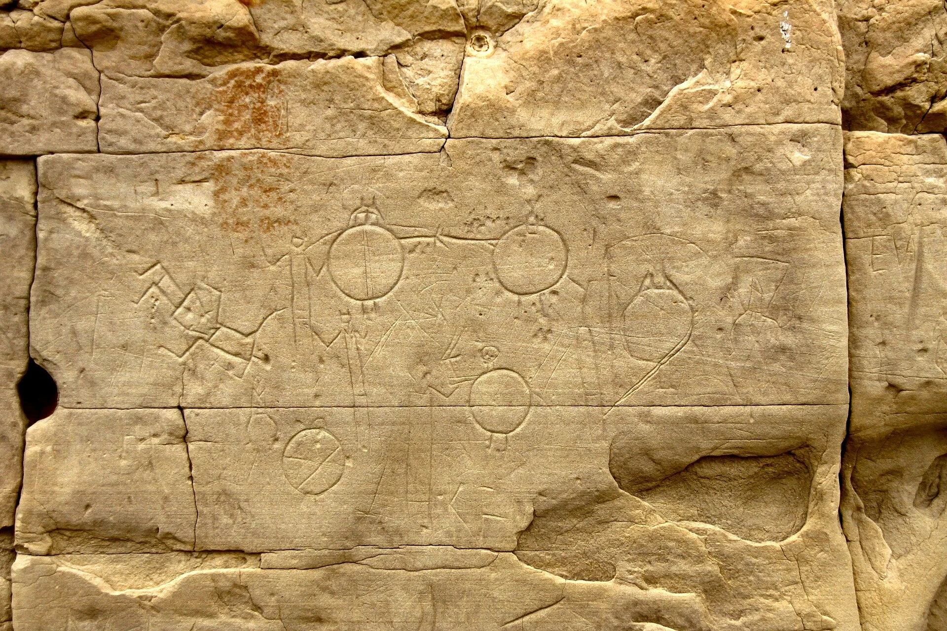
The key choice: independent trail or Archaeological Preserve
The park offers guided interpretive outings within the archaeological preserve, including programmes focused on Áísínai’pi’s markings, landscape beings and the relationship between territory and memory. For travellers visiting specifically for the rock art, this is the strongest option: it provides explanation without turning a sensitive place into an improvised search.
The independent option works best for appreciating the hoodoos, grassland and views over the Milk River. Combining both experiences — the visitor centre and a short trail on one hand, and a tour on the other — makes for a fuller visit than trying to reduce everything to photographs of the panels. Do not touch, trace or mark the rocks: adding inscriptions or damaging the formations is vandalism and is prohibited.
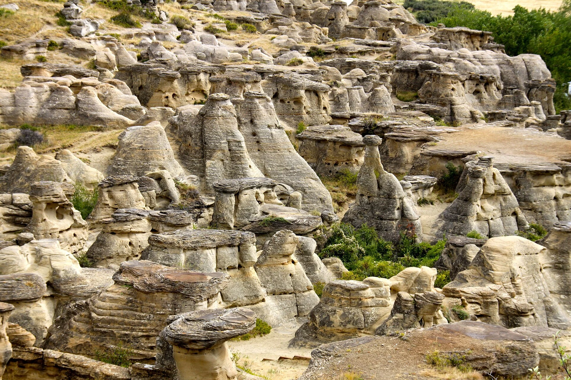
Plan the day from the visitor centre
The park’s natural gateway is the visitor centre, located on the plateau above the valley. It has accessible facilities and a short accessible trail with views towards the river; it is the most convenient place to ask for guidance, confirm guided departures and assess whether the terrain suits your mobility that day.
Because the site is rural, arrange the road journey before setting out and bring water, sun protection and footwear suitable for exposed terrain. Do not plan the day around swimming in the river: water levels and quality may lead to advisories. If your trip coincides with reduced services, prioritise the landscape and available walks, and allow room for operational changes.
Dates, construction work and bookings to check
Visitor-centre hours, guided programmes, open trails and river conditions are variable information. As a specific reference for 2026, Alberta Parks announced the closure of the campground, group areas and vehicle access to the day-use area from 28 September to 15 November 2026 because of construction work; during that period, the day-use area remains open, but the descent from the visitor centre is on foot via the hoodoos trail.
There is also a partial closure in the Coffin Bridge area from September 2026 while a walk-in campground is being built. Check advisories, the closure map, seasonal hours and tour availability directly with Alberta Parks before fixing your dates. Booking a tour can make the difference between a panoramic visit and an experience focused on rock-art heritage.
Official references to check before travelling
- Alberta Parks: park status, advisories and closures, trails, conservation rules, visitor centre and guided programming.
- Government of Alberta: the park management plan and ongoing collaboration with the Blackfoot Confederacy.
- Parks Canada: historical and cultural context for Áísínai’pi as a national historic site.
- UNESCO: inscription, scope of the cultural landscape and protection of restricted-access areas.
References consulted during editorial review. Times, requirements and advisories may change: always confirm with the official source.
- https://whc.unesco.org/en/list/1597/documents/ whc.unesco.org
- https://whc.unesco.org/en/list/1597 whc.unesco.org
- https://whc.unesco.org/en/documents/166291/ whc.unesco.org
- https://whc.unesco.org/en/list/1597/gallery/ whc.unesco.org
- https://whc.unesco.org/en/list whc.unesco.org
- https://whc.unesco.org/document/176175 whc.unesco.org
- https://whc.unesco.org/en/documents/166276 whc.unesco.org
- https://whc.unesco.org/document/208904 whc.unesco.org
- Canadá WikidataCC0 1.0 Wikidata · Q16
- Canada WikidataCC0 1.0 Wikidata · Q14624136
- Canadá WikidataCC0 1.0 Wikidata · Q2569593
- Canada WikidataCC0 1.0 Wikidata · Q13265725
- Cañada WikidataCC0 1.0 Wikidata · Q41660719
- Canada World Countries — mledozeODbL 1.0 World countries dataset by mledoze and contributors · ODbL 1.0
- Canada World Bank Open DataCC BY 4.0 World Bank
- Canada DBpediaCC BY-SA 3.0 DBpedia
- La comercializacion del turismo comunitario en America Latina OpenAlexCC0 1.0 OpenAlex
- Writing-On-Stone Provincial Park GeoNamesDatos geográficos bajo CC BY 4.0; requiere atribución a GeoNames. Fuente: GeoNames
- Writing-on-Stone Provincial Park, County of Warner, Alberta, Canada OpenStreetMapODbL 1.0; atribución y obligación de compartir bases derivadas. Fuente: OpenStreetMap