Brunei · Bandar Seri Begawan
Kampong Ayer on foot and by water taxi from Bandar Seri Begawan
A leisurely visit to the village on the river: which walkways to explore, how to hire a boat and why to add a museum to the route.
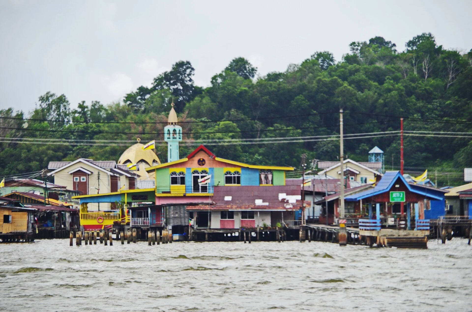
Kampong Ayer is not an isolated attraction opposite the centre of Bandar Seri Begawan: it is a group of inhabited communities on the Brunei River. The best visit combines a short water-taxi ride with a carefully chosen walk and some prior understanding of the crafts that have sustained life on the river. This makes it possible to see the area as a living residential environment, not merely a backdrop for photographs.
Starting at the gallery changes the meaning of the visit
The Kampong Ayer Cultural and Tourism Gallery is a good place to begin because it puts the visit into context before you step onto the walkways. Its exhibitions present the history, neighbourhoods and traditional crafts associated with the settlement, while its location gives you a sense of the scale of the river and the houses built above it.
First, take time to understand what you are seeing: Kampong Ayer consists of several villages, each with everyday services and its own routes, rather than a single tourist street. This perspective helps you avoid treating every home, jetty or mosque as if it were a public stage. Check the gallery’s opening hours before setting out, especially if your stay coincides with a public holiday or Ramadan.
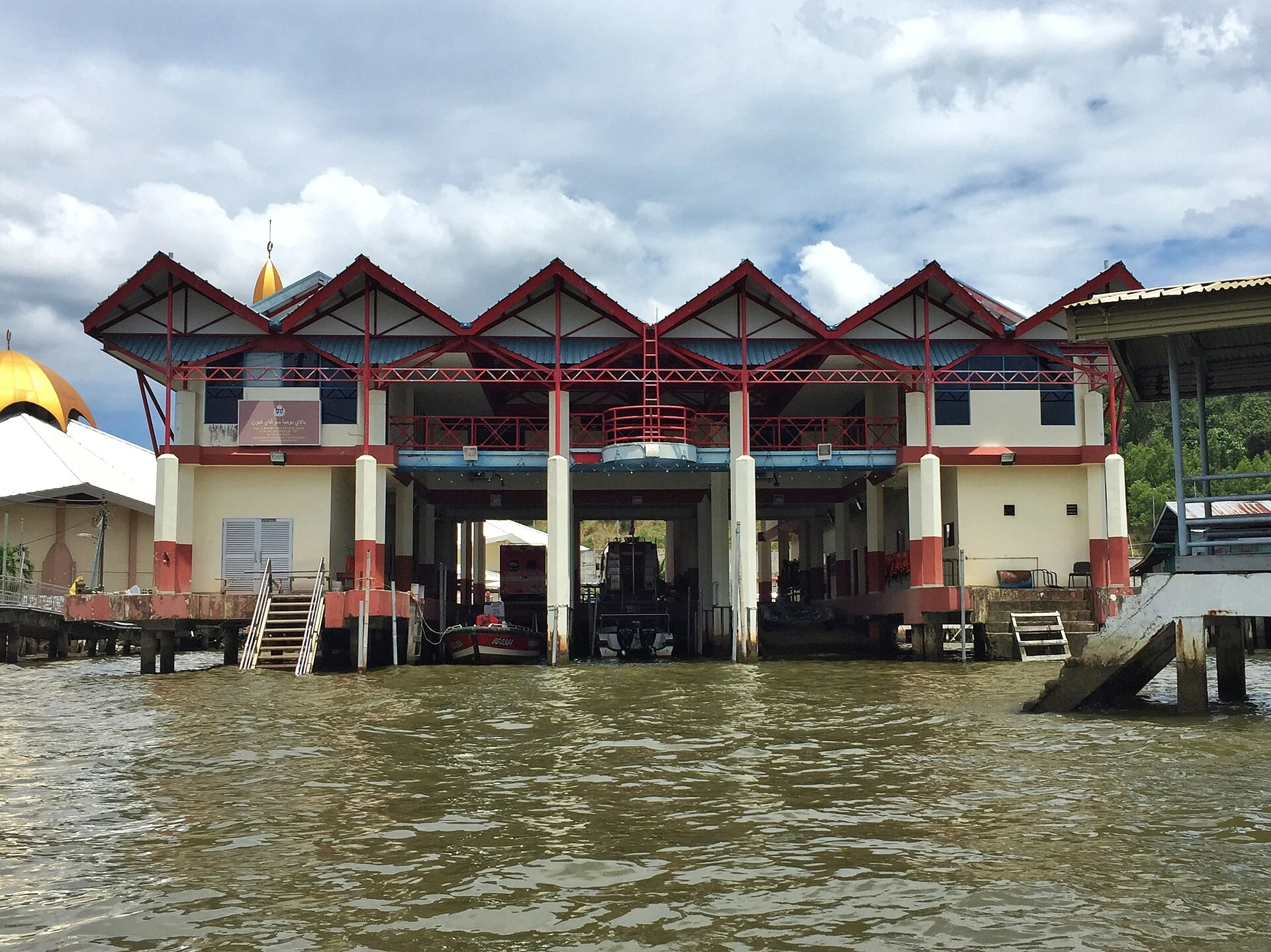
A short route: boat, walkway and return along the same river
From the Bandar Seri Begawan waterfront, agree with a water-taxi driver on a round trip that includes a specific drop-off point. Confirm the total price, route and pick-up point before boarding; do not assume that a scenic circuit and a stop for a walk are the same service.
A sensible option is to get off near the gallery and take your time crossing the wooden bridges and paths in the Peramu area. The official route identifies workshops and references to crafts such as pottery, arch construction and boatbuilding. There is no need to seek out every marked point: the value lies in observing how the walkways connect homes, facilities and jetties.
Wear shoes that fit securely, keep your hands free when boarding and use a life jacket. Some walkway boards and joints require care. If you travel with reduced mobility, a pushchair or bulky luggage, ask in advance about boarding access and the condition of the section you want to walk: the experience depends on transfers and variable pedestrian surfaces.
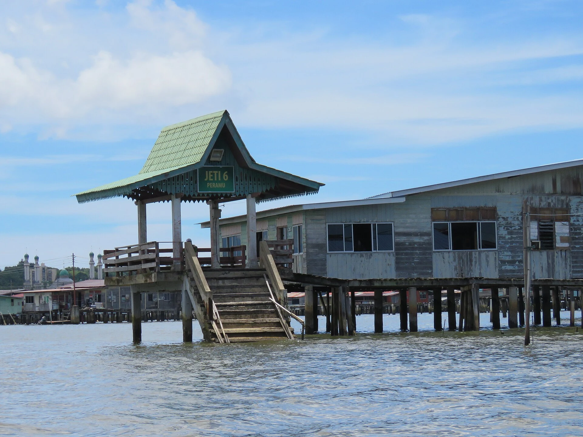
The Malay Technology Museum explains what the walk cannot
To understand that the river was also a place of technical knowledge, set aside time for another stop at the Malay Technology Museum in Kota Batu. Its reconstructions and collections cover forms of housing and activities associated with Kampong Ayer, including fishing, weaving and boatbuilding.
It is not a substitute for seeing the area from the water, but its counterpart: in the village, you see infrastructure and daily life; in the museum, you can identify the tools, materials and crafts that provide context for this relationship with the river. It is best planned as a separate visit, and you should check the current opening hours and access conditions before travelling there.
Visiting an inhabited community with discretion
Walk along the paths as you would through a neighbourhood: let people pass, avoid blocking entrances and do not enter private jetties or homes without an invitation. Ask permission before photographing people, houses at close range or family activities. Lightweight, modest clothing is practical in the heat and respectful of the local context.
A slow crossing is usually preferable to stringing together stops in search of wildlife or views. If you decide to buy food or crafts, or arrange a home-based experience, favour clear agreements and providers connected to the settlement itself. The simplest responsible gesture is to reduce waste: carry a reusable water bottle and take everything you brought with you back out.
What to check on the day
Before setting out, confirm the gallery’s opening hours, the availability of water taxis, the agreed price, the use of life jackets and the weather conditions. If you plan to combine the visit with the museum in Kota Batu, also check its hours, any possible closures and entry requirements. These details can change and determine whether the visit is a relaxed walk or a series of improvised waits and transfers.
References to check before travelling
- Brunei Tourism Development Department: information sheet for the Kampong Ayer Cultural and Tourism Gallery, including its purpose, contact details and notices about public-holiday opening hours.
- Brunei Tourism: general guidance for visiting Kampong Ayer and a map of the Kampong Peramu trail, with recommendations on negotiating the trip, wearing a life jacket and walking carefully along the paths.
- Brunei Museums Department: information about the Malay Technology Museum and its collections devoted to the techniques and activities of Kampong Ayer.
- Radio Television Brunei: institutional reminder about wearing life jackets on water taxis and speedboats.
References consulted during editorial review. Times, requirements and advisories may change: always confirm with the official source.
- https://www.bruneitourism.com/wp-content/uploads/2024/12/BDF_2024_FestivalEGuide.pdf www.bruneitourism.com
- https://www.bruneitourism.com/places/kampong-ayer/ www.bruneitourism.com
- https://www.bruneitourism.com/wp-content/uploads/2025/03/Kg-Ayer-Walking-Trail_compressed_2.pdf www.bruneitourism.com
- https://www.bruneitourism.com/wp-content/uploads/2020/04/Brunei-Tourism-Temburong-Brochure-3.pdf www.bruneitourism.com
- https://kr.bruneitourism.com/tourist-information-centres/ kr.bruneitourism.com
- https://www.bruneitourism.com/wp-content/uploads/2019/08/Kg-Ayer-Walking-Trail_compressed.pdf www.bruneitourism.com
- https://www.bruneitourism.com/wp-content/uploads/2019/08/Bird-Watching.pdf www.bruneitourism.com
- https://www.bruneitourism.com/vby2027/ www.bruneitourism.com
- Brunéi WikidataCC0 1.0 Wikidata · Q921
- Brunei World Countries — mledozeODbL 1.0 World countries dataset by mledoze and contributors · ODbL 1.0
- Brunei Darussalam World Bank Open DataCC BY 4.0 World Bank
- Brunei DBpediaCC BY-SA 3.0 DBpedia
- Bandar Seri Begawan GeoNamesDatos geográficos bajo CC BY 4.0; requiere atribución a GeoNames. Fuente: GeoNames
- Bandar Seri Begawan, Mukim Kianggeh, Brunei-Muara District, Brunei OpenStreetMapODbL 1.0; atribución y obligación de compartir bases derivadas. Fuente: OpenStreetMap
- Brunei River GeoNamesDatos geográficos bajo CC BY 4.0; requiere atribución a GeoNames. Fuente: GeoNames
- Brunei River, Buang Tekurok, Mukim Lumapas, Brunei-Muara District, BJ2924, Brunei OpenStreetMapODbL 1.0; atribución y obligación de compartir bases derivadas. Fuente: OpenStreetMap
- Brunei International Airport OpenFlightsODbL 1.0 (base de datos) / DbCL 1.0 (contenidos) Brunei International Airport · OpenFlights · ODbL 1.0