Palau · Koror Southern Lagoon
Palau’s Rock Islands: Exploring Marine Lakes and Reefs by Boat
A day by boat among the Rock Islands calls for thoughtful choices: Jellyfish Lake may not define the experience, while reefs, designated coves and ancient traces give the journey its meaning.
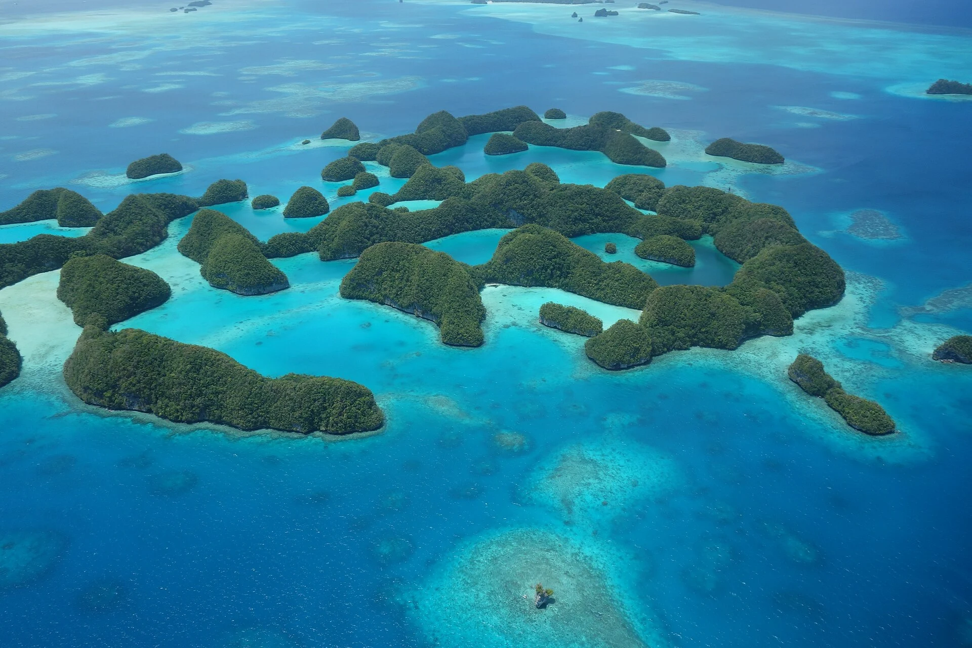
The Rock Islands are neither a water-park attraction nor an archipelago where you can improvise landings. They form a vast lagoon of limestone islands, reefs and marine lakes, where visitor access is regulated and ecological values coexist with a long Palauan history. The useful approach is to set aside a day for the whole experience—boating, reef and landscape—and treat Jellyfish Lake as one possible element rather than the sole reason for the trip. That makes it easier to accept that the route, swimming spots and condition of the lake may vary, and that respecting designated areas is part of the visit.
A landscape best understood from the water
The southern lagoon contains 445 uninhabited limestone islands shaped by vegetation, rain and the sea. From the boat, the point is not to rack up stops but to notice how a barrier reef, channels, coves, caves and island forests form a compact system.
The pace of an outing depends on the swell, the light and the sites authorised for that day. It is therefore worth choosing a trip that explains its itinerary in concrete terms—scenic cruising, a beach stop, snorkelling and transfer time—rather than promising a rigid checklist of icons. If your main aim is scuba diving or several dives, a general island tour may not be the best choice; if you want to read the landscape and alternate between sea and land, it is a good fit.
Jellyfish Lake: a delicate possibility, not a promise
Ongeim’l Tketau, known internationally as Jellyfish Lake, is one of Eil Malk’s marine lakes. Its appeal comes from a distinctive population of golden jellyfish and from the physical separation between the lake and the ocean. That ecological uniqueness explains why swimming is limited to surface swimming with a mask, rather than scuba diving.
Do not organise your entire trip around this stop. The presence of jellyfish, access rules and the lake’s inclusion in commercial routes may change. Check before buying your permit both that the visit is actually available and that the current usage conditions apply; if the lake is closed or not included in your tour, the lagoon still offers reefs, channels and designated tourist beaches.
In the water, wear sun-protective clothing and follow the guide’s advice about personal-care products. The priority is to avoid disturbing a lake with an especially fragile chemical and biological dynamic.
The human story of islands now without permanent residents
Reducing the Rock Islands to a backdrop for photographs erases a decisive part of the place. Several islets contain remains of stone villages, terraces, burial sites and rock art documenting prolonged human use of the marine environment. Communities moved from some islands to larger ones between the seventeenth and eighteenth centuries, but ties to ancestral places remain present in Palauan oral traditions, names and cultural practices.
Not all of these places can be visited, nor should they become tourist stops. This distinction matters: heritage here does not mean unrestricted access. Ask whether your trip includes responsible cultural interpretation, but do not request landings in areas closed to visitors, collect objects or approach cavities and remains without permission.
Permits, boats and practical decisions
The route is travelled by sea, and visitors need the appropriate use permit for the lagoon’s tourist areas; Jellyfish Lake requires a specific authorisation. The operator may arrange the purchase, but that does not replace checking what the permit covers, how long it is valid and whether the lake is included on your chosen date.
Regulations distinguish visitor areas from other waters, lakes and land with restricted access. Book with an authorised operator who can explain this zoning and what happens if sea conditions require the route to be changed. Bring reusable water, sun protection, a light layer for the journey and footwear that can get wet. Reaching the lake usually involves a short walk inland from the landing point, so ask in advance whether you need specific mobility assistance.
The best approach is simple: do not feed or touch wildlife, remove no shells or coral, do not chase animals for a photograph, and accept that a route change may be a protective decision rather than an incomplete excursion.
Sources to check before booking
- Koror State Government, Department of Conservation and Law Enforcement: consult its Rock Islands Southern Lagoon map and guide to confirm zoning, tourist areas, permits, restrictions and navigation conditions that apply on your date.
- Discover Palau, Jellyfish Lake listing: check the access status, swimming rules and sun-protection recommendations for Ongeim’l Tketau.
- UNESCO World Heritage Centre, Rock Islands Southern Lagoon: use it to prepare for the site’s ecological and cultural dimensions, including its marine lakes and settlement remains.
- Bureau of Tourism of the Republic of Palau: use it to verify the operator’s status and licence before booking a trip.
References consulted during editorial review. Times, requirements and advisories may change: always confirm with the official source.
- https://whc.unesco.org/en/list/1386 whc.unesco.org
- https://whc.unesco.org/en/statesparties/pw whc.unesco.org
- https://whc.unesco.org/en/decisions/4783 whc.unesco.org
- https://www.unesco.org/en/world-heritage/list www.unesco.org
- https://whc.unesco.org/document/116720 whc.unesco.org
- https://whc.unesco.org/en/list/1386/assistance/ whc.unesco.org
- https://whc.unesco.org/en/news/2621 whc.unesco.org
- https://whc.unesco.org/en/list/1386/maps/ whc.unesco.org
- Palau WikidataCC0 1.0 Wikidata · Q24419413
- Palau WikidataCC0 1.0 Wikidata · Q333389
- Palau WikidataCC0 1.0 Wikidata · Q24851948
- Palaú WikidataCC0 1.0 Wikidata · Q1978638
- Palau World Countries — mledozeODbL 1.0 World countries dataset by mledoze and contributors · ODbL 1.0
- Palau World Bank Open DataCC BY 4.0 World Bank
- Palau DBpediaCC BY-SA 3.0 DBpedia
- Jellyfish Lake GeoNamesDatos geográficos bajo CC BY 4.0; requiere atribución a GeoNames. Fuente: GeoNames
- Jellyfish Lake, Koror, Palau OpenStreetMapODbL 1.0; atribución y obligación de compartir bases derivadas. Fuente: OpenStreetMap