Comoros · Ngazidja · mountain and conservation
Karthala on Grande Comore needs a flexible ascent plan
On Karthala volcano, the important decision is not reaching the caldera: it is assessing the state of the massif, the effort involved and the journey’s real margin for change.
Conditions described in the guide: confirm current requirements and access with the official source before travelling.
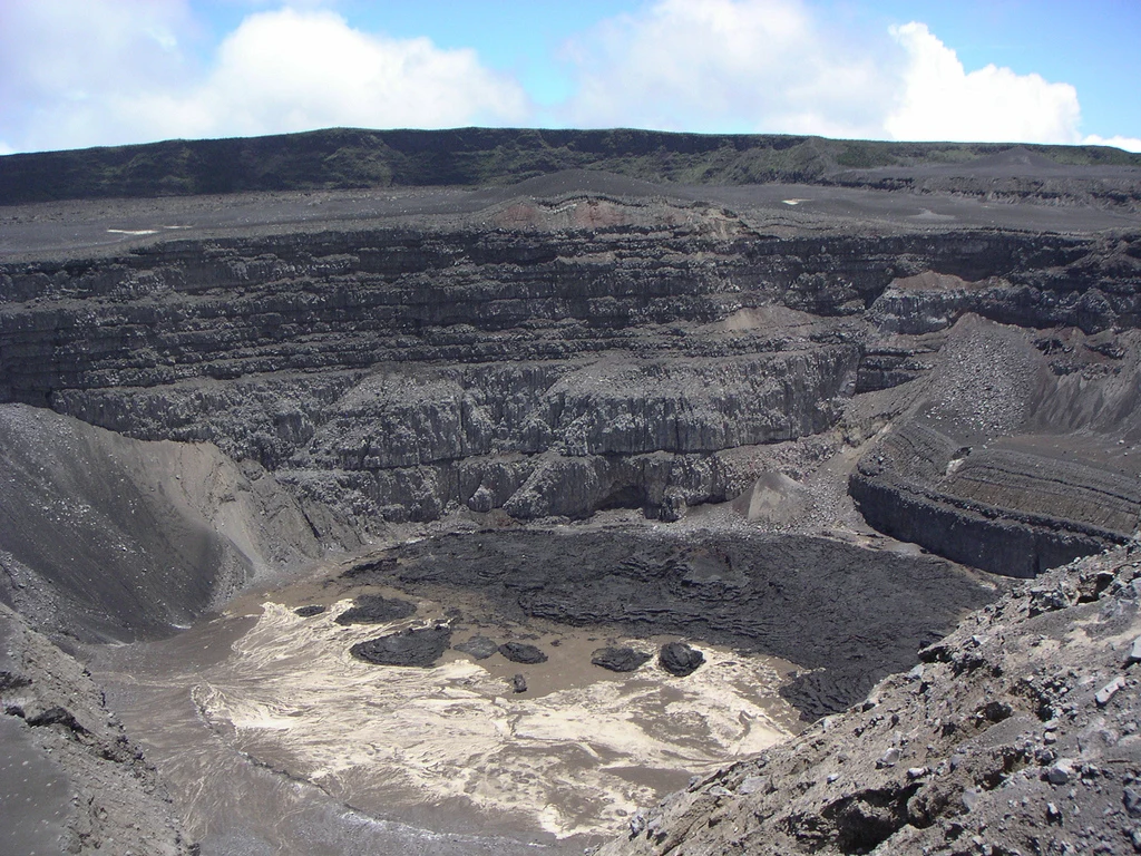
Karthala dominates Ngazidja, the main island of the Comoros, with volcanic terrain rising from inhabited settlements through humid forest and highland heath to a vast caldera. This is not an excursion to squeeze between two transfers: the volcano’s activity and the day’s conditions determine the plan. For travellers with time and good physical fitness, the experience can be a way to understand how conservation, landscape and daily life are connected on Grande Comore; for those seeking a predictable walk, the wisest objective may be an approach into the forest with a local guide. The summit is not the only measure of a good visit.
A massif that changes as you gain altitude
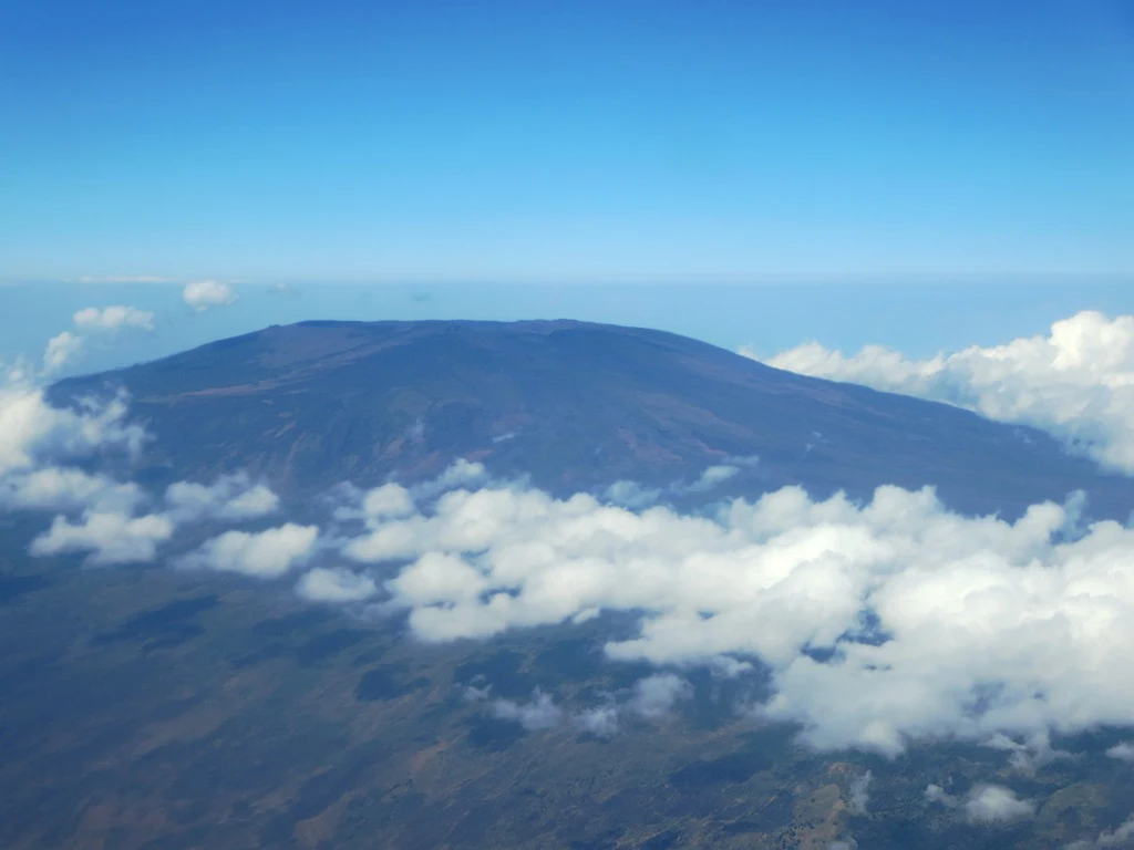
Karthala is an active volcano standing at about 2,350 metres and occupying a considerable part of Ngazidja. Its appeal is not limited to the caldera: on the upper slopes, humid forest gives way to mountain scrub and open high-altitude formations. This transition turns the ascent into a way of reading ecosystems, not simply a sporting challenge.
Karthala’s forest is home to plant species and birds with very restricted ranges. Walking attentively — without playing bird calls, leaving the agreed trail or chasing wildlife for photographs — is a practical way to reduce pressure on an environment whose value depends precisely on its fragility. The national park is managed under co-management with local communities, so hiring a guide from the area provides practical guidance and connects the visit with this conservation economy.
Do not count on panoramic views: mist, wind and cloud can completely change how the landscape is perceived. The forest and the changing vegetation are reason enough for a shorter outing if conditions advise against continuing.
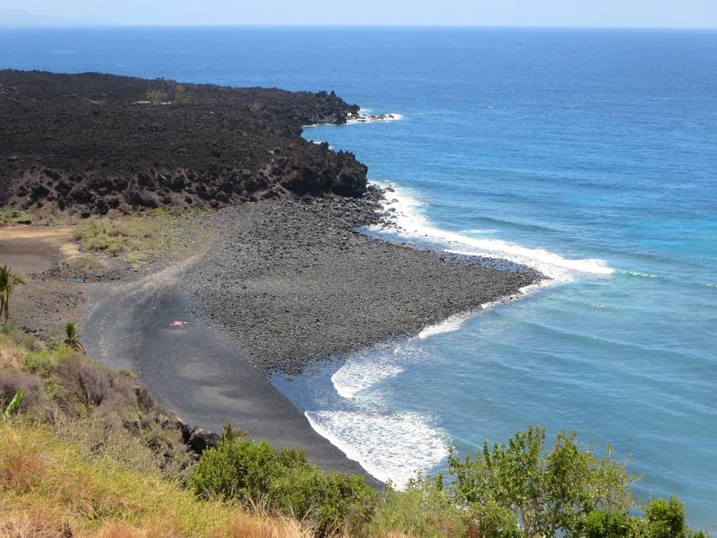
Choosing a forest approach or a summit day
Before booking, ask a more useful question than “can we reach the top?”: what level of effort, exposure and independence is the group comfortable with? An approach through the forested slopes lets you focus on the landscape and return with time to spare; attempting the caldera means treating the day as a mountain outing, with hiking shoes, protection from rain and sun, enough water, and clothing for a marked change in temperature and humidity.
There is no single duration that applies to every access route or every day. Agree with the guide on the starting point, expected elevation gain, the time limit for turning back, what happens if visibility worsens, and whether the itinerary really includes the caldera or only the upper forest. This conversation prevents an expectation of a “volcanic walk” from turning into an excessively long trek.
In the summit area, there are risks associated with volcanic gases and steam explosions. The decision to climb should therefore not depend on a weather forecast checked days earlier or on old photographs. It should be based on the information available that same morning and on the guide’s judgement.
Moroni as a base, with room in the schedule
Moroni is the logical base for arranging contacts, cash, accommodation and an early departure towards the massif. Set aside a buffer day before or after the walk: it allows you to reschedule because of volcanic activity, heavy rain, road changes or poor visibility, and prevents you from combining the ascent with an inter-island transfer.
If your trip includes other islands, do not treat the sea as a simple logistical link. Official advice warns that the safety standards of small and informal boats vary. Prioritise connections you can confirm locally, reject improvised crossings and keep accommodation alternatives in case a journey is delayed.
Carry cash in several separate places and do not rely entirely on cards or cash machines. It is also sensible to share your walking plan with your accommodation, keep the guide’s contact details and take out a policy covering the planned activities and possible evacuation. These preparations may be less photogenic, but in the Comoros they can matter more than camera equipment.
When to postpone the ascent
There are days when the responsible decision is not to climb. Postpone or cancel if an authority issues a volcanic alert, if the guide considers the route unsafe, if visibility makes navigation impossible, or if signs of fatigue appear before the upper section. Do not camp inside the caldera: official advice expressly discourages it.
It is useful to separate two decisions. One is travelling to Grande Comore, which requires checking advice on health, security, demonstrations and cyclones. The other is hiking on Karthala, which calls for a specific, last-minute check on volcanic monitoring. No editorial guide can replace that consultation.
Check before setting out: the state of volcanic activity, local alerts, trail conditions, the availability of an experienced guide, access roads, medical and evacuation insurance, and the situation of sea transfers. If any of these elements is unclear, enjoy Moroni and postpone the mountain.
References to check before travelling
- Comoros National Parks Agency, Karthala National Park profile: conservation, community co-management and ecotourism guidance.
- Comoros National Biodiversity Information Clearing-House Mechanism, Karthala area: high-altitude ecosystems and endemic species associated with the massif.
- Smithsonian Institution’s Global Volcanism Program, Karthala: morphology, approximate elevation and confirmed eruptive history.
- France’s Ministry for Europe and Foreign Affairs, current advice for the Comoros: volcanic risks, recommendation to use an experienced guide, equipment and the stated discouragement of camping in the caldera.
- Comoros National Tourism Office: directories and practical information for planning, transport and services, which should be confirmed directly before booking.
References consulted during editorial review. Times, requirements and advisories may change: always confirm with the official source.
- https://travel.state.gov/en/international-travel/travel-advisories/comoros.html travel.state.gov
- https://www.gov.uk/foreign-travel-advice/comoros/safety-and-security www.gov.uk
- https://travel.state.gov/en/international-travel/travel-advisories.html travel.state.gov
- https://www.comorostourism.com/en/ www.comorostourism.com
- https://travel.gc.ca/destinations/comoros travel.gc.ca
- https://www.diplomatie.gouv.fr/fr/information-par-pays/comores/conseils-aux-voyageurs-securite www.diplomatie.gouv.fr
- https://exteriores.gob.es/es/ServiciosAlCiudadano/Paginas/Detalle-recomendaciones-de-viaje.aspx?trc=Comoras exteriores.gob.es
- https://www.gov.uk/foreign-travel-advice/comoros/warnings-and-insurance www.gov.uk
- Comoras WikidataCC0 1.0 Wikidata · Q970
- Comoros World Countries — mledozeODbL 1.0 World countries dataset by mledoze and contributors · ODbL 1.0
- Comoros World Bank Open DataCC BY 4.0 World Bank
- Comoros DBpediaCC BY-SA 3.0 DBpedia
- Mount Karthala GeoNamesDatos geográficos bajo CC BY 4.0; requiere atribución a GeoNames. Fuente: GeoNames
- Mount Karthala, Cratère du Karthala, Grande Comore, Comoros OpenStreetMapODbL 1.0; atribución y obligación de compartir bases derivadas. Fuente: OpenStreetMap
- Grande Comore GeoNamesDatos geográficos bajo CC BY 4.0; requiere atribución a GeoNames. Fuente: GeoNames
- Comoro Island GeoNamesDatos geográficos bajo CC BY 4.0; requiere atribución a GeoNames. Fuente: GeoNames
- Grande Comore, Comoros OpenStreetMapODbL 1.0; atribución y obligación de compartir bases derivadas. Fuente: OpenStreetMap
- Grande Comore, Itsandra-Hamanvou, Grande Comore, Comoros OpenStreetMapODbL 1.0; atribución y obligación de compartir bases derivadas. Fuente: OpenStreetMap
- Moroni GeoNamesDatos geográficos bajo CC BY 4.0; requiere atribución a GeoNames. Fuente: GeoNames
- Moroni, Moroni-Bambao, Grande Comore, Comoros OpenStreetMapODbL 1.0; atribución y obligación de compartir bases derivadas. Fuente: OpenStreetMap
- Moroni, Moroni-Bambao, Grande Comore, Comoros OpenStreetMapODbL 1.0; atribución y obligación de compartir bases derivadas. Fuente: OpenStreetMap
- Prince Said Ibrahim International Airport OpenFlightsODbL 1.0 (base de datos) / DbCL 1.0 (contenidos) Prince Said Ibrahim International Airport · OpenFlights · ODbL 1.0